![]()
![]()
![]()
![]()
The Voyages of SV Island Time
Current Blog;
Please note; This site/page is best viewed using Internet Explorer 9.0 or newer. Older Browsers or other browsers may not display correctly.

4 December 2012
Well, I'm writing this sitting at my parents place in Wellington, at 11:30 pm. Needless to say, we are back in Wellington. My two friends, Neil and Lorne, met us in New Caledonia. Jo flew home a few days later.
Once we had an OK forecast, we left Noumea for New Zealand. The Forecasts were very chageable, and continued to be so. We had 3 days on the wind, up to 30 Knots at times, and elected to go to Norfolk to await better weather. Norfolk was good, but the anchorages are poor.Lorne and Neil went ashore (had a swim in the surf onthe way in - capsized the dingy!) but I did not. I'd hurt my left thumb - quite badly bruised - so was sort of one handed, and someone needed to stay with the boat anyway. They had a good day ashore, and managed to get back out to Island Time with no problems.
After our 30 odd hours at Norfolk, the forecast was indicating a weather window for NZ, so we were on our way again. Again to weather for the first 20 odd hours, then the wind slowly dropped right off and left us notoring toward North Cape. That lasted 3 more days until we got to North Cape, when we picked up a Westerly, and had a nice beam reach down the cost to Opua. We tied up for the night on the customs wharf, as it was to late to clear in that day.
As Neil was in a bit of a rush by now to get back to work (!@#2) he left the following day, and Lorne and I got ready to do the short passage down to Auckland, again in good conditions with a beam reach. All fairly uneventful really. Island Time is now safely berthed at Gulf Harbour, and our big Adventure is over until next time. Maybe we'll make it right around then, or possibly start form the Med and finish our Circumnavigation!
For now, it's back to reality, work etc, and to try to replenish the coffers...

22-29th October 2012
On the 22nd I had an early morning start
going to the markets to get fresh supplies to take out for the next week.
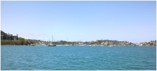
After returning the rental car we made a short trip out of the main port of
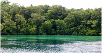
Noumea around to Kuendu Bay. We anchored at GPS 22.15.571
S : 163.23.390 E. This is a delightful bay close to the city but
away from the main tourist trap area. It has a big dive resort that is
currently being revamped and large field for parking and playing games on.
Matt and I headed ashore and decided to go for a little walk up in the scrub
on the peninsular beside the beach. We walked out to the end of the
peninsular and then back to the beach. I had a swim and snorkel while Matt
did some more of the endless boat jobs. I swam out around
the point and found a lovely coral shelf in the nearby marine reserve with
layers of brightly coloured coral, and good fish life. I have noticed that
the cooler water here seems to make the coral appear brighter and more
fluorescent. I also discovered on my snorkel that
this rocky and secluded beach is the local ‘naturalist’ location!
On my return to Island Time Matt was
concerned about the change of wind direction and after getting a new wether
forecast through our sailmail system, decided it was not safe to stay here
for the night so we moved about 1.5 hours away to the anchorage at Dumbea (GPS
22.11.726 S : 166.22.959 E)
23rd October -
This mornings forecast indicated that the weather over the next 3-4 days was
not going to be very pleasant with strong westerlies gusting up to 35 knots.
Matt decided it would be wise to head down to Prony Bay, about 40 nautical
miles away, which is a deep bay on the main island where
the River de Blue Prony comes out. It has numerous sheltered bays, including
a hurricane hideaway hole that is noted in the cruisng guide.
We anchored at Rade de L’Quest Bay (Anchor GPS:
22.21.514 S : 166.48.749 E)
24-25 October – This morning we
moved futher into Prony Bay as the weather deteriorated

Due to the failure of the anchor winch, we had to go back into Port Moselle marina at Noumea to organise repairs, and possibly spare parts. Once in and secure, Matt removed the winch from the deck, and seperated the motor from the gearbox. Fortunately the problem was not as major as Matt initially thought and was able to easily repair it that morning without having to buy parts J . The problem turned out to be a sheared drive pin, and we were able to make one using a bolt, the mains electric drill as a lathe, and a file! Made, inserted (with locktite to keep it there) winch reassembled, reinstalled, tested all OK in only 1/2 a day!! However, the winch will need a serious rebuild when we return to NZ as the gear case is very corroded, and the gearing is looking very tired and worn with all the work it has done, but it can wait till then!
After lunch we decided to walk around the bays and out to the Aquarium des Lagons. After an 1 ½ hour pleasant walk out to Anse Vata beach we reached the aquarium facility. It has a lovely array of sea creatures in realistic surroundings, along with informative notice boards. Afterwards we stopped for a coffee at the main tourist beach of Bay de Citron. Our legs were getting tired by this stage so we decided to take a public bus back to the marina.
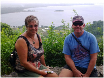
With the marina’s 3 day minimum stay policy, and with the anchor repaired we decided to hire a cheap car for a couple of days and do some inland exploring of the main island of New Caledonia – Grande Terre. It does make a nice change to do some land based travel and see the countryside from the inside and we both felt ready for a change from our normal seascape environment.
 From here we headed
across the island to the east coast town of Thio hoping to visit the mining
museum there. Unfortunately this was closed when we arrived so we continued
on along the minor coastal dirt road that heads North to Canala. This old
mining road is so narrow in places and with steep sided drop-offs into the
river valley that they have a one way system in place for the worst 13 kms
of it. Vehicles travelling north can only use it on odd numbered hours and
those coming south on even numbered hours. It was stunning scenery and quite
a thrilling piece of road to travel over, where you could see the damage
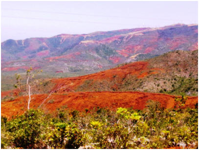
from the strip metal Nickel ore extraction era.
From here we headed
across the island to the east coast town of Thio hoping to visit the mining
museum there. Unfortunately this was closed when we arrived so we continued
on along the minor coastal dirt road that heads North to Canala. This old
mining road is so narrow in places and with steep sided drop-offs into the
river valley that they have a one way system in place for the worst 13 kms
of it. Vehicles travelling north can only use it on odd numbered hours and
those coming south on even numbered hours. It was stunning scenery and quite
a thrilling piece of road to travel over, where you could see the damage
from the strip metal Nickel ore extraction era.
After the 13 kms one way system the road twists and
turns inland slightly. In this more fertile agriculture and native bush area
the tribal villages produce crops of mandarins, pineapples, yams
and lychees with some selling their produce at roadside stalls. We
stopped for lunch at a hilltop vista before heading off to try and find the
location of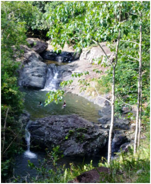 the
sulphurous hot springs. Sadly we were unable to find these hot pools in a
natural river setting as the signposting in this more remote region was
somewhat lacking. After the village of Canala we headed
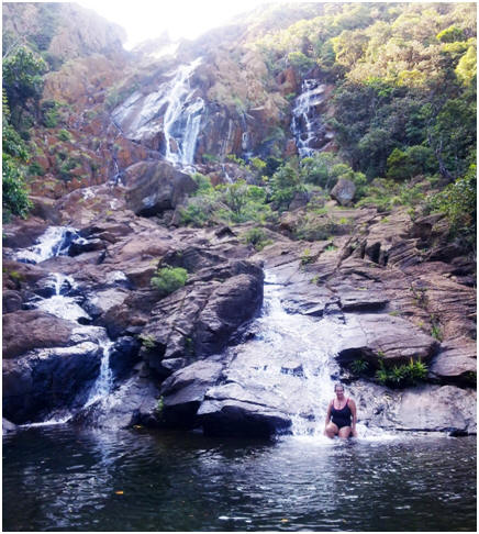
back inland and towards the west coast of the island again. The inland town
of Sarramea settled in the heartland of the tropical forest region was
pretty and bush clad and lots of pretty waterfalls. It has become a mecca
for ecotourism with a variety of small hotels and lodges. We stopped at the
information centre to get details about the botanical walking track which we
wanted to do and then I had a late afternoon and rather refreshing swim in
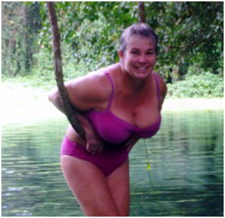
the cool Feillet (Wine Vat) river swimming hole.
the
sulphurous hot springs. Sadly we were unable to find these hot pools in a
natural river setting as the signposting in this more remote region was
somewhat lacking. After the village of Canala we headed
back inland and towards the west coast of the island again. The inland town
of Sarramea settled in the heartland of the tropical forest region was
pretty and bush clad and lots of pretty waterfalls. It has become a mecca
for ecotourism with a variety of small hotels and lodges. We stopped at the
information centre to get details about the botanical walking track which we
wanted to do and then I had a late afternoon and rather refreshing swim in
the cool Feillet (Wine Vat) river swimming hole.
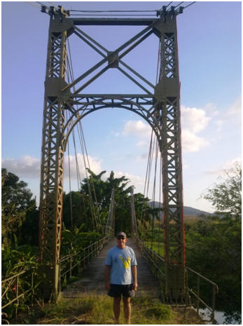
 We also stopped at the Marguerite Suspension bridge
that was designed by the architects of the Eiffel Tower and built in 1909.
We also stopped at the Marguerite Suspension bridge
that was designed by the architects of the Eiffel Tower and built in 1909.
 we
rejoined the main highway south to Noumea just on dark. We completed our day
trip with a meal at a cheap and cheerful hamburger bar out a Citron Bay.
we
rejoined the main highway south to Noumea just on dark. We completed our day
trip with a meal at a cheap and cheerful hamburger bar out a Citron Bay.
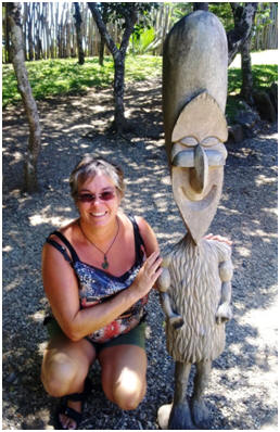
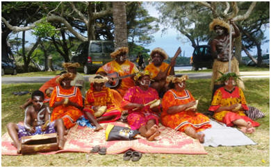
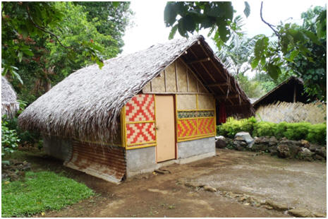
The following day we did a circuit trip of the southern
region of New Caledonia. We started off by visiting the renown Tjibaou
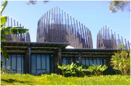 C
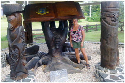
C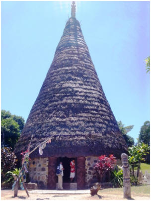 ultural
Centre which is a stunning showcase and display area of the indigenous Kanak
culture of New Caledonia. It was in a quite a spectacular location with an
unusual architecturally designed building, along with traditional style huts
with informative information boards. It was the best value for money thing
we have done in New Caledonia so far.
ultural
Centre which is a stunning showcase and display area of the indigenous Kanak
culture of New Caledonia. It was in a quite a spectacular location with an
unusual architecturally designed building, along with traditional style huts
with informative information boards. It was the best value for money thing
we have done in New Caledonia so far.
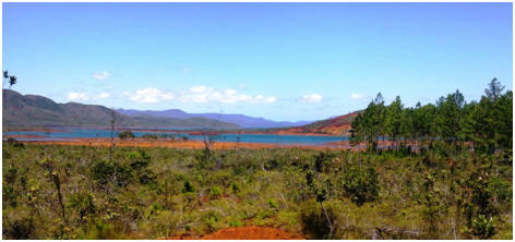
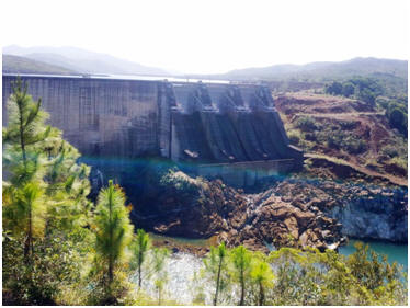 created
by a enormous dam they have created in this area to meet the regions power
demands. We had a picnic lunch here and saw plantations of Kauri trees.
created
by a enormous dam they have created in this area to meet the regions power
demands. We had a picnic lunch here and saw plantations of Kauri trees.
 He was seeking a ride back
into Noumea. He has done a lot of travelling around the world to various
destinations with his job and it was interesting talking to him and getting
his perspective on life in New Caledonia. When we got back
into town we headed to a cheap restaurant to get Free WIFI so we could Skype
our eldest daughter at the family birthday dinner she was having. However
once we got seated they told us it didn’t work so couldn’t Skype after all.
L Then most unexpectdly the
next people to arrive at the restaurant were the parents of our
eldest daughters partner, who were here on a surprise get-away holiday. We
had a lovely time catching up with them both.
He was seeking a ride back
into Noumea. He has done a lot of travelling around the world to various
destinations with his job and it was interesting talking to him and getting
his perspective on life in New Caledonia. When we got back
into town we headed to a cheap restaurant to get Free WIFI so we could Skype
our eldest daughter at the family birthday dinner she was having. However
once we got seated they told us it didn’t work so couldn’t Skype after all.
L Then most unexpectdly the
next people to arrive at the restaurant were the parents of our
eldest daughters partner, who were here on a surprise get-away holiday. We
had a lovely time catching up with them both.

10-16th October 2012
GPS Anchor Position:
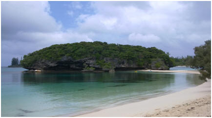
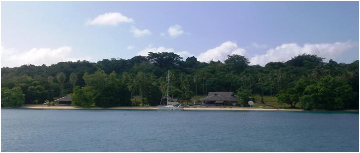
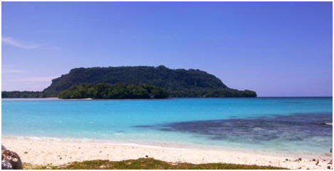
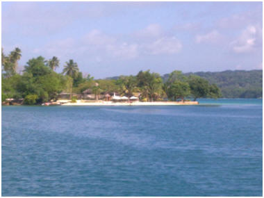
The approximately 60 nautical mile trip down to the popular destination of Isle de Pins was made in easy light wind conditions of under 10 knots from behind us. The wind did strengthen in the afternoon and came around to directly onto our course so we ended up motoring the last hour into the main bay at Kuto. The bay has turquoise coloured water and white sand beaches with bush along the shore line. On our arrival the cruise ship Pearl of the Pacific was at anchor and ferrying boat loads of people ashore to experience the hospitality of the local tribe with custom singing and dancing, samples of local food, day trips around the island or just to enjoy the beach at this location. At the stone wharf the mid-week ferry that comes up from Noumea was docked and was unloading passengers and goods. Kuto Bay was a busy little place with all this activity and people coming and going. When the cruise ship and ferry departed late afternoon it did make for a much quieter and peaceful anchorage with only 10 yachts anchored for the night.
The following day another large cruise ship turned up in the bay with all the craft and food stalls, music and dancing back on again for the latest batch of arrivals. Matt and I went ashore and perused the activity and sampled some of the local cooking on offer. We took our snorkel gear to have a snorkel around the little island in the next bay over, as it supposedly has some good coral. Today however with the cruise ship in town the beach was packed out with 100’s of people in the water enjoying the environment. We did see some good Georgian coral fans around the back of the island, but the place was so busy from the cruise ship you keep bumping into other snorkelers. The place almost needed traffic control!
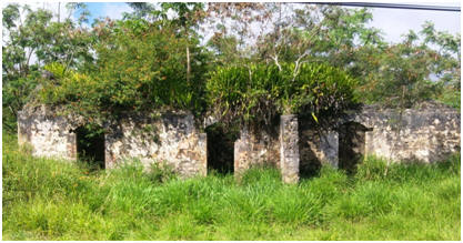 After
lunch the day cleared and we went ashore for some exercise, and to see if we
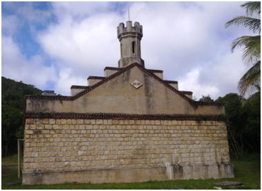
could locate the nearby prison ruins from the days when Isle de Pins was
used by the French as a penal colony. Following the directions in our Lonely
Planet guide we did eventually locate the remains of the now quite overgrown
and dilapidated remains of this by-gone era, when 3000 political prisoners
and convicts were exiled here.
After
lunch the day cleared and we went ashore for some exercise, and to see if we
could locate the nearby prison ruins from the days when Isle de Pins was
used by the French as a penal colony. Following the directions in our Lonely
Planet guide we did eventually locate the remains of the now quite overgrown
and dilapidated remains of this by-gone era, when 3000 political prisoners
and convicts were exiled here.
 On our
return from our walk we decided to detour past the New Zealand boat called
Kiwi Coyote that we had seen come into the anchorage a couple of days ago to
say hello. They kindly invited us onboard and gave us a guided tour of their
lovely 46 foot yacht designed by Greg Elliot. This more modern designed
‘touring’ but fast performance sailing style of yacht is one that Matt has
often talked about as a possible upgrade from Island Time, should we
financially get into a position where we can afford to do this.
I hadn’t seen one before so it was interesting to see what Matt had
been talking about. It was also enjoyable to share stories with another
yachtie couple, and to hear their exploits and
experiences. Robin originally from the USA is a software designer, and like
Matt has had since childhood had many years of sailing experience. She has
owned and sailed a number of yachts all around the world. Her partner Simon
is an architect and has designed some interesting buildings in New Zealand
and got involved in the sailing lifestyle after meeting Robin.
On our
return from our walk we decided to detour past the New Zealand boat called
Kiwi Coyote that we had seen come into the anchorage a couple of days ago to
say hello. They kindly invited us onboard and gave us a guided tour of their
lovely 46 foot yacht designed by Greg Elliot. This more modern designed
‘touring’ but fast performance sailing style of yacht is one that Matt has
often talked about as a possible upgrade from Island Time, should we
financially get into a position where we can afford to do this.
I hadn’t seen one before so it was interesting to see what Matt had
been talking about. It was also enjoyable to share stories with another
yachtie couple, and to hear their exploits and
experiences. Robin originally from the USA is a software designer, and like
Matt has had since childhood had many years of sailing experience. She has
owned and sailed a number of yachts all around the world. Her partner Simon
is an architect and has designed some interesting buildings in New Zealand
and got involved in the sailing lifestyle after meeting Robin.
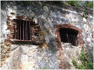
Prison Water Pump House
built 1874-1875.
Still used by the local
community until quite recently.
 You can see
the platform where she would have rested/slept. By this stage of the day we
were getting pretty hungry so we headed out to Oro Bay where the Meridien
Resort is situated in this idyllic forest setting, sand beach and views out
into the bay where you can see large stands of the t
You can see
the platform where she would have rested/slept. By this stage of the day we
were getting pretty hungry so we headed out to Oro Bay where the Meridien
Resort is situated in this idyllic forest setting, sand beach and views out
into the bay where you can see large stands of the t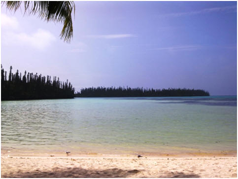 all
and slim columnar trees known as Pin Pines that the Island gets its name
from.
all
and slim columnar trees known as Pin Pines that the Island gets its name
from.
We had a very pleasant and quite economic lunch here in this stunning location. Also enjoying lunch on the deck was the crew from Kiwi Coyote that we had meet the day before. We invited them to come to our boat for sunset drinks at the end of their day tour. After lunch we did the walk out to the popular location known as the natural swimming pool. It is really just a large reef rock pool with clean turquoise coloured water and a few tropical fish swimming in it. I enjoyed a snorkel and explore while Matt had a afternoon siesta. We returned to the car via the estuary river track and ocean side of the island and then continued our travels South to the main village town of Vao. I was hoping to pick up a few groceries from the store here to top up our supplies and by using some of my very little French with a group of local ladies in the village got directions to a little store to get some goodies. It was then time to complete our circuit tour of the island, return the rental car and get organised for sunset drinks with the Kiwi Coyote crew onboard our yacht. It was very pleasant and enjoyable day tour and made a change from the beach and water scenery.
As the weather was still too windy to head back comfortably towards Noumea and the inner lagoon we did a day trip out to the next little island beyond Isle de Pins to Brossie Island. We anchored in behind the reef for the island at GPS: 22 42.286 S 167 27.379 E. We were the only yacht here and so after lunch I had a snorkel on the reef. The construction of this reef was quite unusual in that it had lots of tunnels and channels you could swim through and into with good sized fish to view in the crevices. Whilst I was swimming Matt did some work replacing the fuel lift pump and raw water pumps (from spares) that had been annoying him for some time with small leaks into the bilge (he hates having in engine room dirty!) At sunset we enjoyed a lovely sunset stroll down the white sands beach of this little atoll that we had all to ourselves – gave you quite a romantic tropical island paradise feeling J
The next day we headed back into the shelter of Kuto Bay at Isle de Pines again as the wind was gusting up to 25 knots again – making the coral atoll anchorage bumpy and uncomfortable. The next day the wind had settled down again and was at last blowing in the right direction to give us a nice sailing angle to head back into the inner lagoon and to explore some other coral atolls and islands. We left mid-morning and made a run down to Ndo Island. This was another isolated but pretty looking coral atoll with nice white sands and a enclosed anchorage space inside its coral reef. The recommended anchoring space from the cruising guide was very narrow with not a lot of room. After putting the anchor down we were not happy with how close to the reef we were so decided to pull it up and try to reposition ourselves. Just as we got the anchor off the bottom our electric anchor winch failed with still 15 odd metres of chain over the side. It was quite breezy at this anchorage and Matt had to pull the remaining chain and anchor in by hand while I slowly motored around in the narrow reef gap. Bugger! We had thought we were looking forward to a night in this pretty location but without an anchor (we can anchor manually, but it is slow and phisically difficult - not safe in this confined anchorage) we could not stay, so instead headed back further into the lagoon to Maitre Island (with moorings)where we had been on our way out to Isle de Pines. We had a good sail back to Maitre with the wind from almost directly behind us. Matt even got our large spinnaker sail out which hasn’t been used in ages and enjoyed the run back to Maitre getting up to 10-11 knots of boat speed at times - very good speed for us without surfing. We arrived at Maitre Island just as the last of the daylight was disappearing (just as well it was a fast sail!) and picked up the mooring bouy in the last of the fading light.

9th October 2012
GPS Mooring Position: 22.20.100
S:166.24.300 E
Back into the inner lagoon to Maitre Island which is a small but very popular resort island and anchorage with about 15 free moorings you can use, and which is close by to Noumea - only 3 nautical miles away. We planned to just stop here overnight as a sheltered stop off point before heading down the main channel around the Southern Lagoon area that is known as the “woodin canal” before making a trip out to the famous outer Island of Isle de Pins.

6-8th October 2012
GPS Anchor Position:
Leaving the marina at lunchtime it was a quick 1 ½ hour
downwind sail to Signal Island 12 nautical miles away.
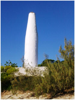 Signal Island gets its
name from the large white coral block constructed marker (see pic) that was
erected on this island in the early 19th Century. It was used to
mark the break in the outer lagoon reef beyond this island that was the
closet exit for the sailing convict ships heading back to France from New
Caledonia.
Signal Island gets its
name from the large white coral block constructed marker (see pic) that was
erected on this island in the early 19th Century. It was used to
mark the break in the outer lagoon reef beyond this island that was the
closet exit for the sailing convict ships heading back to France from New
Caledonia.
 The island is now
a nature reserve and so the next day I went for a little snorkel on the reef
to see the underwater scenery. Although the water wasn’t particular clear it
was pleasing to see some really good sized reef fish, and live coral. It has
been our experience that where countries have developed restricted fishing
zones and conservation practices that the size and quantity of fish rapidly
increases and the reef recovers from being overfished and damaged as a
result. J The water temperature here near the outer reef was
only 21.5 °C. I was quite chilled by the time I got back from
my exploration having been used to sea temperatures of between 27-34°C
the last couple of years, so I had to have a hot water shower to warm up
afterwards.
The island is now
a nature reserve and so the next day I went for a little snorkel on the reef
to see the underwater scenery. Although the water wasn’t particular clear it
was pleasing to see some really good sized reef fish, and live coral. It has
been our experience that where countries have developed restricted fishing
zones and conservation practices that the size and quantity of fish rapidly
increases and the reef recovers from being overfished and damaged as a
result. J The water temperature here near the outer reef was
only 21.5 °C. I was quite chilled by the time I got back from
my exploration having been used to sea temperatures of between 27-34°C
the last couple of years, so I had to have a hot water shower to warm up
afterwards.
The next day Matt and I both went for a snorkel – but this time we dug out our 3 and 5mm wetsuits to keep warm. As it was Sunday all the local boaties and campers who had come out on the ferry went home in the late afternoon and we had the whole island to ourselves. So we enjoyed a sunset walk around the island with the wildlife even more active now that most of the humans had disappeared before going back to the yacht for dinner.

2-6th October 2012
Marina GPS Position:
VHF Channel 67

29th September -1st
October 2012
After filling up with duty free fuel at the Port Vila
fuel wharf and topping up our water tanks we exited the harbour at around
10.30am. It was a nice clear day with an easy 10-15 knot sailing breeze from
abeam. The lovely sailing conditions lasted through the night and throughout
the next day, dying off to seven knots as we approached the main reef and
channel entrance for New Caledonia on Monday 1st October.
It was a pleasure to finally have an ocean passage where there is actually some wind, and it is going is going the right direction! After spending the majority of the last two years around the equator region where there is little wind, and the last couple of months trying to head South against the prevailing trade winds it was a pleasure to have 2 whole days of pleasant sailing conditions. However as we drop another few degrees South in latitude, and with more of a wind chill factor in place we have both had to dig out our polar fleece sweatshirts and shoes and socks to wear in the evenings and early morning sailing watches. This clothing has not seen the light of day in the last 2.5 years and I must say it feels quite odd having your feet back in enclosed shoes again. I guess it will help us to acclimatise to the New Zealand summer temperatures! We have also noted that with increasingly clearer blue skies over our heads we are more easily sunburnt, so are having to slap the sunscreen on a bit more again as well.

20 September 2012
GPS Anchor Position: 17.44.870
S : 168. 18.625 E
On our way down to Port Vila we stopped at Paul’s Rock (GPS: 17.39.874 S:168.10.848 E), a local dive spot in very clear water with great visibility and a pretty array of coral and fish life. It was well worth the stop.
Here in Port Vila we are restocking and refuelling before our trip across to New Caledonia. The town has a number of high rise buildings now compared to our previous visit in 2003, but in many aspects still the same.
Whilst we were here Matt arranged to have two new Hydraulic Hoses made up for the Auto Pilot steering system,as he had recently noticed the old ones were perished. He also replaced our boarding platform shower hose that had sprung a leak, along with a number of other checks - normal boat maintenance.
 The trip back down
the steep driveway from the gardens in the drivers beaten up old van was a
bit of a hair raising adventure ride in its own right! The driver barrelled
down the road, brakes skidding only one or two wheels, around sharp corners
with large drops, and with brakes fading out as we neared the bottom! We
were pleased to get down in one piece!
The trip back down
the steep driveway from the gardens in the drivers beaten up old van was a
bit of a hair raising adventure ride in its own right! The driver barrelled
down the road, brakes skidding only one or two wheels, around sharp corners
with large drops, and with brakes fading out as we neared the bottom! We
were pleased to get down in one piece!
Then, on return to Island Time in the harbour, we had one of those ‘it’s a small world incidences’- we were approached by an English yachty couple who now reside in New Zealand, but were on a yacht moored nearby . They asked us do you have a daughter in Wellington?” We replied “ yes - we have two”. They then asked “is one of them interested in Parrots?” “Yes our eldest – Sue” we said. As it turned out their daughter who is studying at Victoria University, in Wellington also has a parrot, and our Sue had recently looked after it whilst their daughter had a holiday with them on their yacht.
Anyway after nine days in Port Vila a suitable weather window opened up to start the passage across to New Caledonia. There were about six international yachts who had all been waiting in Vila for the weather, and so we all ended up leaving as a group on the same day. It is always quite nice on an open ocean passage to know other yachts are nearby for assistance if need be.

19th September 2012
GPS Anchor Position: 17.33.015
S : 168.17.020 E
We had a great day sail of around 50 nautical miles down to the top of Efate Island in 8-10 knots of wind from abeam. This meant it was actually ad day where we could sail, it was a pleasure to have our Genaker (a type of spinaker) up. Havannah harbour is an excellent, sheltered natural harbour with a variety of bays to choose from to anchor in. We arrived in good time so had a quick swim, the late afternoon brought the ominous sounds of a thunderstorm but it didn’t eventuate to anything much.

GPS Anchor Position:
16.43.710 S : 168.08.657 E

This was a busy anchorage with around 9 boats at anchor. We headed ashore for a stroll along the beach and village area. Stopped for a drink at Paradise Lodge, and caught up with various other cruisers and fishermen. The Sailing Ship Soren Larson was here also en route to Port Villa. The weather forecast was not suitable for moving on for a day or two so we were laid up here waiting for a weather change. I hoped to catch sight of the Dugong that resides in this bay but was not lucky enough to do so, although Matt thought he heard it surface nearby. Lots of turtles around though, and I love watching them gracefully glide through the water.

15th September 2012
We head further along the coastline of Ambryn Island to Buwoma Bay which has hot springs oozing out of the cliffs below the volcano. I enjoyed an exploratory swim along the coastline with the warm water bathing over me. The black volcanic sand bottom made the rocks and coral very clear to see. Unfortunately the wind began to swing around bringing in waves and surf to the bay making it unsuitable for an overnight anchorage, so we continued on around the corner to Craigs Cove which was a much calmer and better anchorage. We had a quick visit ashore to stretch our legs and obtain permission to snorkel. The water here is very clear and I saw numerous turtles and spectacular 1.5 metre lump head parrot fish gracefully swimming around the bay.

14th September 2012
GPS Anchor Position: 16.08.38 S
: 168.07.08

GPS Anchor Position:15.47.200
S: 168.09.700 E
13th September 2012
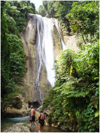
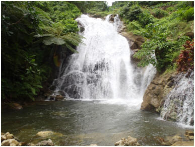
It was a pleasant short 16 nautical mile hop down the coast to this bay, where a picturesque waterfall can be seen pouring down the hillside just behind the bay. It was an easy 10 minute walk up to the waterfall and the water was a crystal clear aquamarine colour in the pools in which you could see the fish swimming around in. It was pleasant to escape the middle of the day heat with a cooling swim in the pools.

GPS Anchor Position: 15.33.210
South: 168.08.301 East
We spent our days here waiting for a better weather window. We offered the fix-it skills of both Bruce from Sea Going and Matt to the two volunteer Australian teachers at the Mission school to fix up the plumbing problems. They spent a couple of days following the waterpipe up the hill but it was a job beyond repair, really requiring the replacement of the entire water pipe to the village, as it was broken in over 20 places, and what wasn't was full of scale. The pipes used to go over 5 km's into the bush, up a steep hill.

8th September 2012
GPS Anchor Position:
15.22.490 S:168.07.900 E

GPS Anchor Position:
15.16.880 E: 167.58.880 S
 Island
was a real mix of conditions. We had winds gusting up to 30 knots and
swinging right around the compass, and also a period of flat calm.
Island
was a real mix of conditions. We had winds gusting up to 30 knots and
swinging right around the compass, and also a period of flat calm.
Lolowai anchorage is inside an old sunken volcano crater which you carefully enter by passing over the shallow rim on the seaward side. Also at anchor was another NZ yacht called ‘Sea Going’ from Tutukaka.
I went for a snorkel the next day whilst Matt looked at and cleaned out the engine bay, and did a repair job on our automatic steering system. We were invited for drinks on See Going with Rikki and Bruce and discovered we were heading in same direction the next few days so moved on in convoy with them.

5th- 6th September
2012
GPS Anchor Position: 15.27.499
S : 167.13.189 E
It was a quick trip around the bottom of Luganville to this bay at the bottom of Espiritu Santo where we planned to wait for the wind to drop off and move around to a more suitable direction for our hop across to the island of Ambae. It was a pretty little bay with what looked like a rather fancy and exclusive resort. I was quite looking forward to a day or so of exploration of another Blue Hole in this bay and remains of WWII remains in the bush. However that next morning’s forecast showed that we would get the best wind conditions that day for the jump across to Ambae Island. As we don’t want to wait another week for suitable conditions, it was time to move on.

8-20th August 2012
Upon finalising our immigration clearance in Honiara we made the 50 nautical mile trip to the island of Rua Sura (Anchor GPS: 09.29.994S:160.36.072E). One other yacht was anchored here - it was a peaceful and pretty anchorage. The next day we did another 50 nautical mile trip to the bottom of Guadalcanal Island, with a stop late afternoon for a snorkel on the reef at the bottom before moving in towards the main part of the coast and Marua Sound, which is a jumbled system of reefs and islands. We stayed at Marapa Island (09.49.520S:160.51.951E) We were visited by a local man in his canoe who worked at a nearby resort who advised us not to go onto the rocks at the end of the bay we were anchored in as it was a sacred area. The next morning we headed out through a narrow passage - it took us between various islands at the end of Guadalcanal before heading out into the open ocean again and a passage of nearly 60 nautical miles to the small island of Masi on the eastern side of San Cristobel Island (GPS 10.17.036S:161.43.297E). On the 11th August we started our 240 nautical mile passage across to the Santa Cruz group of islands. We motor sailed almost the entire distance, as the wind was light, then right on the nose. Just before our arrival at Santa Cruz the radar once again was playing up fading in and out and being unreliable. We ended up spending 3 days anchored here (GPS 10.42. 940S:165.49.902E), waiting for better weather and doing boat maintenance. Matt spent some time trying to resolve the radar issue, changed the oil in saildrive unit and we both spent a bit of time reading. Our next jump was a 270 nautical mile trip to Espirito Santo, when the wind turned towards east from SSE. This made the passage sailable, (on one tack) and therfore easier. The passage turned out to be quite rough, 2-3m steep seas, but quite sailable and relatively fast.
Due to the uncomfortable conditions at around 7pm we ended stopping at Hiu Island in the Torres group of Islands in Vanuatu at Central Bay (GPS 13.06.650S:166.33.153E), thinking that we would stop for a nights rest. We had dinner and then after getting the latest forecast decided it would be unwise to stay here as the forecast was for deteriorating conditions that would see us stuck in this less than ideal anchorage for several days. We made the decision to continue on towards Luganville.
20-26th August 2012
We were last in Luganville in 2003 when we were here with our children on our pacific island cruise. The town has developed quite a lot in that time and is considerably busier with a lot more vehicles on the road. It is still essentially a one road with an assortment of general merchandise stores, liquor outlets, banks, petrol stations and a few cafes, along with a fresh fruit and vege market. On arrival, after customs clearance, we took a mooring off Aore Island Resort (which is across the channel on the island opposite Luganville town, GPS: 15.32.302S:167.10.711E). We enjoyed a very tasty meal there our first night, with Matt making the comment that the steak was the best one he has had since leaving New Zealand. Luganville is located on the island of Espirtu Santo and is reknown for the quality of the local beef. We moored here for 3 nights but found it expensive with the mooring charge of $1500 vatu a night (approx. $18 NZ), and the cost of dingy fuel to go across the channel to the township. We decided to check out the other anchorage at the western end of the town, offshore from the Beach Front Resort (GPS: 15.31.388S.167.09.848E). Although not as sheltered, is it much more accessible to town by walking or a $200 vatu taxi ride. The resort staff are much more yachtie friendly, and laundry charges were ½ the price of Aore Resort.
Whilst in Luganville we restocked with supplies, and Matt fixed the Volvo Engine fresh water pump that we replaced in May, and which has leaked slightly since then - it was slowly getting worse. Matt was not at all impressed with this Volvo part which was very expensive to replace at $1600 and been leaking through a factory assembled gasket since then. He discovered there was grit/foreign object contamination in the original gasket seal that has been causing the problem. He also did an oil change, replaced the lifting hinge on our front bunk that had rusted out, and replaced our front hatch seal that has been leaking, and now that we are doing more sailing passages to weather and getting a lot more water over the deck our bed has been getting quite wet. Finally Matt also identified the current problem with the radar – the quatech RS422 covnverter that allows PC connection had an intermittent fault. We’ve ordered a new one – from the USA via fedex much cheaper than a new radar, so that is good!

27 -28th August 2012
GPS Anchor Position:
15.08.648S:167.06.974E
 We
arrived at the Champagne Beach anchorage just before lunch, and you could
clearly see why it has the reputation as one of the most special beaches in
Vanuatu. Cruise ships make a special stop here as part of their Vanuatu
tour. It has a lovely curved white sand beach, with clean and clear
aquamarine sea, and bush down to the beach. We anchored in the small bay
next to Champagne beach as this was less affected by the rolling swell.
Another 3 yachts came in that afternoon/evening. The next morning was not
really beach weather with showers of rain coming through but it cleared up
late morning and we headed ashore to walk on the beach and investigate the
coral/fish life on the nearby reef. A family from another yacht had already
set up their picnic beach spot and advised us the custom landownership fee
was 500 vatu per person. We swaped yachtie stories with this family from
Hobart, Australia and then continued on our walk down the stunning beach
meeting another tourist from Holland who was quite badly sunburnt and hiding
in the shade of the trees reading a good book. Matt and I both commented how
nice it was to virtually have this popular beach virtually to ourselves. If
this beach was in the Northern Hemisphere it would be covered in beachgoers,
littered with beach loungers and umbrellas, restaurants and accommodation.
We
arrived at the Champagne Beach anchorage just before lunch, and you could
clearly see why it has the reputation as one of the most special beaches in
Vanuatu. Cruise ships make a special stop here as part of their Vanuatu
tour. It has a lovely curved white sand beach, with clean and clear
aquamarine sea, and bush down to the beach. We anchored in the small bay
next to Champagne beach as this was less affected by the rolling swell.
Another 3 yachts came in that afternoon/evening. The next morning was not
really beach weather with showers of rain coming through but it cleared up
late morning and we headed ashore to walk on the beach and investigate the
coral/fish life on the nearby reef. A family from another yacht had already
set up their picnic beach spot and advised us the custom landownership fee
was 500 vatu per person. We swaped yachtie stories with this family from
Hobart, Australia and then continued on our walk down the stunning beach
meeting another tourist from Holland who was quite badly sunburnt and hiding
in the shade of the trees reading a good book. Matt and I both commented how
nice it was to virtually have this popular beach virtually to ourselves. If
this beach was in the Northern Hemisphere it would be covered in beachgoers,
littered with beach loungers and umbrellas, restaurants and accommodation.

30-31st August 2010
Anchor GPS 15.02.132S:167.04.999E
 We
went ashore and enjoyed a fresh water swim in one of the lakes after getting
a local to show us the way - a short walk through the bush and old farmland
from the days when this Island was used as a cattle farm. The lake was below
a cutting of limestone cliffs and surrounded by bush. We had the whole place
to ourselves as no-one lives on the island anymore, it was very peaceful
with only the sound of the birds and wind rustling in the treetops.
We
went ashore and enjoyed a fresh water swim in one of the lakes after getting
a local to show us the way - a short walk through the bush and old farmland
from the days when this Island was used as a cattle farm. The lake was below
a cutting of limestone cliffs and surrounded by bush. We had the whole place
to ourselves as no-one lives on the island anymore, it was very peaceful
with only the sound of the birds and wind rustling in the treetops.
The next day we went across to the main village which
is predominately French speaking with the remains of an old missionary. We
met a family strolling along the beach who came from Wellington. They were
up here visiting their eldest son who is doing a 10 months VSA stint up
here. We shared a drink at a newish local beach restaurant and then were
joined by a well-known carver who was up here doing some work for the
restaurant and the new beach
 bungalows
they were building. He told us about the local legend of the islands here
and then showed us where the village shop was. He also showed us some large
Coconut crabs they have secured. I had heard stories about the enormous
coconut crab that can open a coconut with its claws. Sadly they are now rare
creatures as they are slow breeding and been over-exploited for eating.
bungalows
they were building. He told us about the local legend of the islands here
and then showed us where the village shop was. He also showed us some large
Coconut crabs they have secured. I had heard stories about the enormous
coconut crab that can open a coconut with its claws. Sadly they are now rare
creatures as they are slow breeding and been over-exploited for eating.

GPS Anchor Position:
15.22.458 S:167.11.424E

1.8.2012
 10
years ago. It was a full day of adventuring – starting off at 8am when we
were collected by the driver in his Toyota Ute. Our seating was sitting in
the tray of the ute on a cane sofa chair with no cushions! We sped along the
road and had to put on our raincoats when it started to rain. As we raced
past the countryside it was interesting to see the number of cattle farms on
the old coconut plantations which are now predominately run by ex-pat Kiwis
and Ozzies. After we left the main road we
10
years ago. It was a full day of adventuring – starting off at 8am when we
were collected by the driver in his Toyota Ute. Our seating was sitting in
the tray of the ute on a cane sofa chair with no cushions! We sped along the
road and had to put on our raincoats when it started to rain. As we raced
past the countryside it was interesting to see the number of cattle farms on
the old coconut plantations which are now predominately run by ex-pat Kiwis
and Ozzies. After we left the main road we
 headed
inland to the interior rainforest along a wet and slushy 4WD off road track,
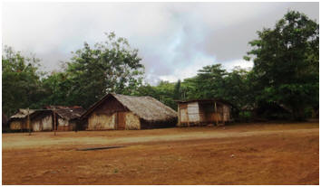
passing numerous traditional style villages with their naturally constructed
bungalows and subsistence living off the land lifestyle.
headed
inland to the interior rainforest along a wet and slushy 4WD off road track,
passing numerous traditional style villages with their naturally constructed
bungalows and subsistence living off the land lifestyle.
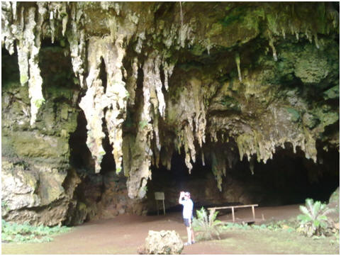
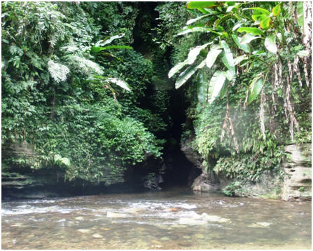
The wet and slushy tracks continued after we reached the road end, but now we had to negotiate them by slipping and sliding through them on foot. Our guides were very helpful and grabbed you if it looked like you were about to fall. We were with a group of 5 yachties so we all had stories to share along the way to pass the time. The guides stopped at various places to give us samples of local bush tucker or tell us the various medicinal purposes of the plants for their custom healing. They told about plants that could cure HIV and Cancer! We did discuss whether we should patent their ideas and tell the drug companies of these wonderful natural drugs the claimed to have!
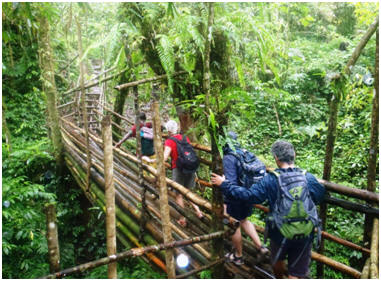 down rope and bamboo ladders over moss strewn boulders to the entrance
of the cave. The walk through the cave was in waist high water at times,
with many bats, swallows and other insects and limestone formations flowing
down the wall. After an hour’s walk/wade through the cave we emerged back
into day light at the other end of the cave tunnel for a break for lunch on
the edge of the river, with waterfalls cascading around us, and stunning
verdant green bush and birdlife surrounding us.
down rope and bamboo ladders over moss strewn boulders to the entrance
of the cave. The walk through the cave was in waist high water at times,
with many bats, swallows and other insects and limestone formations flowing
down the wall. After an hour’s walk/wade through the cave we emerged back
into day light at the other end of the cave tunnel for a break for lunch on
the edge of the river, with waterfalls cascading around us, and stunning
verdant green bush and birdlife surrounding us.
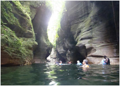 This
part was through a narrow river gorge where you swam various sections,
climbed over house sized rocks at other times, in order to get to the next
swimmable section. It was all very natural and primitive with just ropes or
chains in the more tricky part to help you clamber over the rocks. The
scenery through the gorge was stunning – it felt like you were in an Indiana
Jones type movie setting! After about 1.5 hours in the gorge we had to climb
back up to the muddy trail via bamboo ladders, and climbing up the rocks of
a small waterfall. It was then another hour of
This
part was through a narrow river gorge where you swam various sections,
climbed over house sized rocks at other times, in order to get to the next
swimmable section. It was all very natural and primitive with just ropes or
chains in the more tricky part to help you clamber over the rocks. The
scenery through the gorge was stunning – it felt like you were in an Indiana
Jones type movie setting! After about 1.5 hours in the gorge we had to climb
back up to the muddy trail via bamboo ladders, and climbing up the rocks of
a small waterfall. It was then another hour of
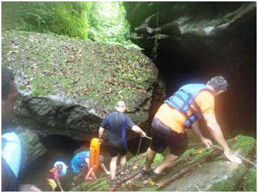 trekking
back through the slippery mud tracks to a local village to clean off some of
the mud before we were taking back to town and out to Oyster Island where
our yachts were all moored for a well deserved hot shower, a drink or two
and a meal before collapsing into bed exhausted. It was a memorable and fun
day.
trekking
back through the slippery mud tracks to a local village to clean off some of
the mud before we were taking back to town and out to Oyster Island where
our yachts were all moored for a well deserved hot shower, a drink or two
and a meal before collapsing into bed exhausted. It was a memorable and fun
day.
2 September 2012
We had a well deserved line-in the next morning with our calf muscles feeling rather tight after the exertions of the Millennium Cave tour the day before. We headed ashore to get some washing done at Oyster Island resort and to use their internet connection to catch up on our mail. They were hosting a Father’s Day Buffet meal at lunchtime so I took the last two places and we joined a group of eight yachties who were also celebrating. Matt enjoyed his Fathers Day treat with plenty of steak and wine. After lunch while Matt had a snooze I went for a snorkel on the reef behind the resort to find the WWII Cosair Plane wreck that was located just off the beach. I found various parts of the plane scattered along the reef which are now well encrusted with coral, then I walked back across the island for a quiet evening of movies and a light meal.

GPS Anchor Position:
15.31.388 S : 167.09.848 E
We head back into Luganville today after a week out cruising the bays around Espiritu Santo. We enjoyed our time out and caught up with a variety of yachties who have been doing the pacific season. Matt picked up the parcel with the replacement part to fix the intermittent problem with the radar we have had over the last couple of months and is very happy to have his radar working properly again. I had a visit to a Doctor to check out the little toenail I damaged on the Millennium Cave Walk , and we are busy refuelling, watering and obtaining fresh supplies before making our way down the various other islands to the main town/port of Villa over the next couple of weeks.

1-8 August 2012
We enjoyed our time in Honiara with the closest thing to a supermarket that we have seen in months, it has also been an opportunity for us to see some of the Olympics on the TV at the yacht club. We meet up with a group from the Island Cruising Association on our arrival and went on a tour of Honiara with them. We enjoyed their company and sharing some meals whilst here. Matt purchased a replacement Navigation computer here, as he has been having on-going issues with trying to keep our system going using the parts of about 3 different old ones over the last few months, and this simply hasn’t been reliable enough. We also did a trip out to a war relics site one day that was quite interesting.

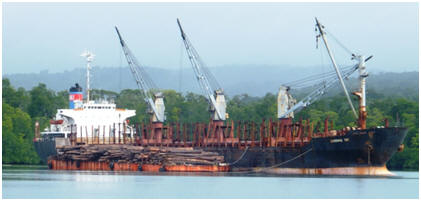
The trip down to the Russell Island group is just over 50 nautical miles away, but as we will be heading directly into the wind again our passage making will be slow. The wind has eased off from previous days and we have around 15-17 knots most of the way. We motorsail with one reef in the mainsail. A couple of cargo ships pass us on the way and we arrive at the Nggee Bay anchorage (GPS 09.02.102 S : 159.05.370 E) around 5pm.
 This
Nggee Bay anchorage had a wind funnel effect between the landforms so was
quite breezy. We enjoyed our sundowner drinks in the cockpit and a BBQ meal,
followed by an early night.
This
Nggee Bay anchorage had a wind funnel effect between the landforms so was
quite breezy. We enjoyed our sundowner drinks in the cockpit and a BBQ meal,
followed by an early night.
 It
was peaceful again in Tillotson Cove where we anchored at lunchtime. (GPS
09.04.303 S : 159.11.880 E). We soon
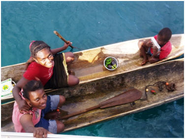
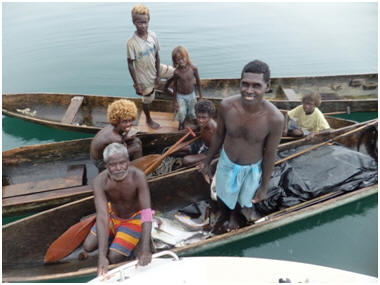
had canoe loads out to visit us. The girls were talkative, but the boys more
shy. We traded a bag of flour for some tomato’s and bell peppers with them.
It
was peaceful again in Tillotson Cove where we anchored at lunchtime. (GPS
09.04.303 S : 159.11.880 E). We soon
had canoe loads out to visit us. The girls were talkative, but the boys more
shy. We traded a bag of flour for some tomato’s and bell peppers with them.
30th July – Today we motored out of the
Sunshine Channel around the corner to the little township of Yadina.
(GPS: 09.04.546 S:159.11.880 E). This town was
 used
in WWII as a base in this area with the remains of huts and wharfs. Latterly
it was used a Copra processing factory and port facility– but those
facilities are all disused now as well. It is now simply
a small village with about 1000 residents. We had read in the Cruising Guide
that it had a market and shops, however we were told the market only
operates on Wednesday and Saturday – today is Monday. We got a few bits and
pieces from the local store that operates out of the old WWII buildings. As
Matt said he can’t imagine the soldiers who built these structures then,
would imagine they would still be around and being used as a grocery store.
used
in WWII as a base in this area with the remains of huts and wharfs. Latterly
it was used a Copra processing factory and port facility– but those
facilities are all disused now as well. It is now simply
a small village with about 1000 residents. We had read in the Cruising Guide
that it had a market and shops, however we were told the market only
operates on Wednesday and Saturday – today is Monday. We got a few bits and
pieces from the local store that operates out of the old WWII buildings. As
Matt said he can’t imagine the soldiers who built these structures then,
would imagine they would still be around and being used as a grocery store.
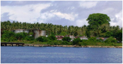 They
are rusty and dilapidated now, with the power and telephone communications
that once ran into these buildings no longer in use.
They
are rusty and dilapidated now, with the power and telephone communications
that once ran into these buildings no longer in use.
 island
in the Solomons and where the capital of Honiara is. It was an easy trip
down to there and we anchored at Tambea (GPS: 09.10.142 S:159.28.878 E).
We had come to the resort here at Tambea 20 years ago on a dive trip to
the Solomons and were looking forward to having a couple of resort style
days here. Sadly the place was destroyed 10 years ago after ethnic fighting
over land ownership. Only the concrete foundations of the buildings exist,
and the swimming pool which is now a slimy bug invested pond. We enjoyed a
beach walk and snorkel on the outer reef and had a peaceful night here in
the bay before heading to Honiara the next day.
island
in the Solomons and where the capital of Honiara is. It was an easy trip
down to there and we anchored at Tambea (GPS: 09.10.142 S:159.28.878 E).
We had come to the resort here at Tambea 20 years ago on a dive trip to
the Solomons and were looking forward to having a couple of resort style
days here. Sadly the place was destroyed 10 years ago after ethnic fighting
over land ownership. Only the concrete foundations of the buildings exist,
and the swimming pool which is now a slimy bug invested pond. We enjoyed a
beach walk and snorkel on the outer reef and had a peaceful night here in
the bay before heading to Honiara the next day.

We left Lever Harbour at 7.30am on the 25th,
with an escort of Dolphins and Swiftlets as we left the harbour. Matt is not
feeling well this morning so after getting out of the harbour he went back
to bed. We motor down the coast of New Georgia Island in the shelter of the
island. By mid-morning the rain had settled in properly, reducing visibility
and the wind had come up to 17-21 knots which we were heading straight into
reducing our progress. It has been good to see much more fish life and bird
life as we head further and further south. I put fishing line out today in
hopes of catching something for dinner – no luck today. We entered into
Marovo Lagoon via of Charapoana Passage, with dolphins yet again in the
entrance to greet us. We anchored at 2pm behind the reef island of Uepi .
(GPS: 08.27.059 S : 158.03.773 E)
 if
we could have a meal at the resort that night. Sadly they were full with
in-house guests and could not feed two more people. We checked out the gift
shop (this was to give us an indication of prices of products, that the
various carvers would bring out to show us while
travelling in Marovo Lagoon as indicated in the Solomon Islands Cruising
Guide). We went for a walk around the resort to stretch our legs, before
heading back to the yacht before the next rain squall came in. It was a wet
afternoon and evening so we had a relaxed time watching a movie, with no
interruptions from local visitors for a change.
if
we could have a meal at the resort that night. Sadly they were full with
in-house guests and could not feed two more people. We checked out the gift
shop (this was to give us an indication of prices of products, that the
various carvers would bring out to show us while
travelling in Marovo Lagoon as indicated in the Solomon Islands Cruising
Guide). We went for a walk around the resort to stretch our legs, before
heading back to the yacht before the next rain squall came in. It was a wet
afternoon and evening so we had a relaxed time watching a movie, with no
interruptions from local visitors for a change.
 didn’t
buy his carving, but gave him some spare medical dressings we had and some
canned corned beef for his family. After signing Lulu’s visitor book we
headed further down the lagoon. I did some more baking on the way and around
11.30am when the weather closed in once again making it difficult to see the
reefs we stopped behind another islet for an hour while the rain front
passed over. The locals all tell us the weather has been most
didn’t
buy his carving, but gave him some spare medical dressings we had and some
canned corned beef for his family. After signing Lulu’s visitor book we
headed further down the lagoon. I did some more baking on the way and around
11.30am when the weather closed in once again making it difficult to see the
reefs we stopped behind another islet for an hour while the rain front
passed over. The locals all tell us the weather has been most uncharacteristic over the last month with a lot more wind and rain virtually
every day. It has made the lagoon very green, when normally it is quite
clear. It hasn’t been as good for snorkelling as we had hoped.
uncharacteristic over the last month with a lot more wind and rain virtually
every day. It has made the lagoon very green, when normally it is quite
clear. It hasn’t been as good for snorkelling as we had hoped.
The next morning we rise just prior to sunrise in order to reach the Russell group of Islands. As we leave the outer reef and cliffs of Marovo lagoon behind us we are greeted with a lovely sunrise peaking over the top of the cliffs. Marovo lagoon is reputedly the world’s largest lagoon, we have enjoyed travelling through this area over the last few days and interacting with the local inhabitants. It has been a peaceful and sheltered waterway to transverse through.

It was a drizzly morning again, I woke early and went ashore for a morning walk and to get some fresh supplies at the morning fruit and vege market while Matt got his beauty sleep. We were away by 9am heading up Hathorn Sound to the northern end of New Georgia Island, passing the village of ‘Paradise’ on the way. We can now say we have seen “Paradise”. It was then down the coast of New Georgia to the Lever Harbour Entrance. We followed the navigation markers through the outside reef to the inner harbour. Lever Harbour is named after the international company of Unilever who established a logging operation and town here. We were greeted on arrival by numerous locals who came and visited us offering fish, fruit, carvings and flowers in lieu of biscuits or lollies, pens and paper for the children.

23 July 2012
 from
the water collection system Matt has rigged to collect water off our bimini
(which is a canvas structure over the steering wheel that protects you from
sun & rain). I also discovered our rear guest cabin mattress was quite wet
from the overnight rain. We could see water running down the inside of the
hull. Matt discovered that the stern rail that holds up our 15 HP motor is
loose and lifting off the deck letting water run down inside. Matt fixed
this by unscrewing the bolts and put some bathroom sealant around the area
and then screwing it down again. It really needs
from
the water collection system Matt has rigged to collect water off our bimini
(which is a canvas structure over the steering wheel that protects you from
sun & rain). I also discovered our rear guest cabin mattress was quite wet
from the overnight rain. We could see water running down the inside of the
hull. Matt discovered that the stern rail that holds up our 15 HP motor is
loose and lifting off the deck letting water run down inside. Matt fixed
this by unscrewing the bolts and put some bathroom sealant around the area
and then screwing it down again. It really needs
 some
Sikaflex marine sealant to waterproof the area. However we have not been
able to source this product since running out a few months ago.
some
Sikaflex marine sealant to waterproof the area. However we have not been
able to source this product since running out a few months ago.
 Also
as there was Telecom service here we replenished our internet connection, as
we had used up the allowance we had purchased in Gizo on Skype calls to home
& updating the website! That afternoon I went for a snorkel on
the reef and cleaned the hull. Matt did some more passage planning and
navigating for the passage we are going to make down to Honiara over the
next few days.
Also
as there was Telecom service here we replenished our internet connection, as
we had used up the allowance we had purchased in Gizo on Skype calls to home
& updating the website! That afternoon I went for a snorkel on
the reef and cleaned the hull. Matt did some more passage planning and
navigating for the passage we are going to make down to Honiara over the
next few days.

22- 23 July 2012
We left Gizo today to head to Vona Vona lagoon and in a
south easterly direction towards Honiara. Vona Vona lagoon is a large body
of shallow water approx. 11 nautical miles wide and 17 nautical miles long.
This large lagoon is very sheltered and studded with a myriad of islets and
reefs. We used the Solomon Islands Cruising Guide with its mud maps and
notes to traverse this poorly charted lagoon. It was a very
 entering
the lagoon through a gap in the outer reef, with waves crashing on either
side of us, it was a relief to be in the inner sanctuary and calmness of the
lagoon. Just inside the lagoon we saw a small pod of dolphins going past. We
stopped at Snake Island (GPS Position 08.10.551 S : 157.02.979 E),
for a swim and lunch stop. I saw a very interesting deep blue waving soft
coral that I have not seen before here and baby rock lobsters. After lunch
we continued on through the lagoon and the narrowing passageway
anchor for the night at a small islet between Mundahite and Talisondo
Islands. (GPS 08.17.304 S : 157.10.124 E)
entering
the lagoon through a gap in the outer reef, with waves crashing on either
side of us, it was a relief to be in the inner sanctuary and calmness of the
lagoon. Just inside the lagoon we saw a small pod of dolphins going past. We
stopped at Snake Island (GPS Position 08.10.551 S : 157.02.979 E),
for a swim and lunch stop. I saw a very interesting deep blue waving soft
coral that I have not seen before here and baby rock lobsters. After lunch
we continued on through the lagoon and the narrowing passageway
anchor for the night at a small islet between Mundahite and Talisondo
Islands. (GPS 08.17.304 S : 157.10.124 E)

GPS Anchor Position for Port
Gizo: 08.05.914 S : 156.50.358 East
We spent 4 days in the harbour town of Gizo. It’s
a small one main street town, with a number of Chinese general
merchandise stores, a few hotels mostly for diving groups that come here, a
reasonable fish/fruit and vege market, a jail, hospital and various
Governmental Offices.
It has been quite breezy while we have been here with up to 25 knots at time so feel we are really back in the trade wind belt now. We are enjoying having more air circulation through the boat which helps us to feel cooler, and there seems to be less humidity in the air now as well. We completed our normal tasks of clearing in with officials which was quite a bit more complicated here with similar systems to Oz/NZ. We had to see Customs, immigration and Quarantine officers, and it cost us nearly $300NZ to clear into Gizo which we thought was expensive for this economy and level of service!
 We enjoyed chatting with the local people
many who want to make a better life for themselves, but are struggling in
this economy. They tell us there are big problems in the Solomon’s with land
ownership and many disputes. Also that the Government that is selling off
much of the best land to overseas interests, and letting the local fisheries
being overfished by offshore commercial operators, leaving the locals with
little. Several of them were interested in talking to me
about education when they found out I was a preschool teacher. I enjoyed
answering some of their questions in this area. We also bought a couple of
things from a local stone carver and will find a place to put them in our
new home when we return, as a memento of our travels here.
We enjoyed chatting with the local people
many who want to make a better life for themselves, but are struggling in
this economy. They tell us there are big problems in the Solomon’s with land
ownership and many disputes. Also that the Government that is selling off
much of the best land to overseas interests, and letting the local fisheries
being overfished by offshore commercial operators, leaving the locals with
little. Several of them were interested in talking to me
about education when they found out I was a preschool teacher. I enjoyed
answering some of their questions in this area. We also bought a couple of
things from a local stone carver and will find a place to put them in our
new home when we return, as a memento of our travels here.

June 21st-July 16th
After leaving Biak on the 21st June, we had
4 day passage (500 nautical miles) to the outer islands of Papua New Guinea.
This is the longest passage we have
 completed in quite some time, as usually
it’s been day hops or just an overnighter. We started out
in ideal conditions making use of our large Gennaker sail and some good
progress. Later in the afternoon the rain came in causing us to reduce sail
with many heavy rain squalls continually passing over us until the early
hours of the next day when we were once again able to properly sail. Mid
afternoon on the 23rd the wind died down, it calmed off and I got
out the sewing machine and repaired our BBQ and Outboard motor covers.
Sadly around 7.30pm on the 23rd our Radar stopped working.
It has been intermittently powering itself off, and slowly getting worse.
completed in quite some time, as usually
it’s been day hops or just an overnighter. We started out
in ideal conditions making use of our large Gennaker sail and some good
progress. Later in the afternoon the rain came in causing us to reduce sail
with many heavy rain squalls continually passing over us until the early
hours of the next day when we were once again able to properly sail. Mid
afternoon on the 23rd the wind died down, it calmed off and I got
out the sewing machine and repaired our BBQ and Outboard motor covers.
Sadly around 7.30pm on the 23rd our Radar stopped working.
It has been intermittently powering itself off, and slowly getting worse.
The Radar is a very useful tool when shorthanded sailing as it can be set it to have a guard zone around us that picks up virtually anything that comes in our path, not just big ships but also small local canoes that are out fishing or (sometimes in perfect conditions) even large logs that can damage your hull. This is particularly helpful at night when it is very difficult for the human eye to see these objects especially if there are any waves. It is also useful for confirming the accuracy of our position on the charts we are using, as the radar shows you exactly where the coastline is in relation to where the chart says it is.

25-26th June 2012
GPS ANCHOR POSITION: 01.17.952
S: 144.15.605 E

GPS ANCHOR POSITION: 01.32.922
S : 145.00.498 E
 Matt
had been keen to visit this reef for some time as there are many wrecks here
and sailing stories abound of their tales. We nearly added to these tales on
our approach to the reef ourselves, as the outside entry point on the chart
proved to be ½ mile out and in the low light of our dawn entry this was not
easy to pick this up until we could see waves breaking on the reef in front
of us! If our radar had been working we would have been altered to this
problem earlier... Anyway after quickly backing up we found the correct reef
entry point further along, safely entered the reef and found ourselves an
anchorage on the far side out of the swell coming in, in front of a small
fishing village. After a morning snooze to recover from our
unsettled overnight passage we went for a snorkel on the nearby reef and
investigated the fishing village but no-one was around. We enjoyed a
peaceful night here and had no visitors at all during our stay here.
Matt
had been keen to visit this reef for some time as there are many wrecks here
and sailing stories abound of their tales. We nearly added to these tales on
our approach to the reef ourselves, as the outside entry point on the chart
proved to be ½ mile out and in the low light of our dawn entry this was not
easy to pick this up until we could see waves breaking on the reef in front
of us! If our radar had been working we would have been altered to this
problem earlier... Anyway after quickly backing up we found the correct reef
entry point further along, safely entered the reef and found ourselves an
anchorage on the far side out of the swell coming in, in front of a small
fishing village. After a morning snooze to recover from our
unsettled overnight passage we went for a snorkel on the nearby reef and
investigated the fishing village but no-one was around. We enjoyed a
peaceful night here and had no visitors at all during our stay here.
 28 June-6th July 2012
Kavieng Port Anchor Position by Nusa Island:
02.35.110 S : 150.46.910 E
Matt is keen to keep moving quickly along through the Papua New Guinea group of Islands before the South Easterly seasonal currents and winds built up in intensity as the season develops. We have read and heard stories of currents running in this area against the direction we are going of up 4 knots. This would make our passage making south very difficult, slow and laborious - as our average sailing speed is about 6 knots.
It was a four day sailing passage from Hermit Reef to Port Kavieng. We had managed to time our passage to coincide with a north westerly wind pattern and had very comfortable downwind sailing conditions for the first 1 ½ days in between 20-30 knots which meant we covered the miles quickly. On the second night the wind started to steady at 30 knots with heavy rain squalls coming through on a regular basis. As we don’t have radar now to see incoming rain squalls at night we took the precaution of reefing down our mainsail. Whilst I was up on deck bringing the mainsail down my optically correct glasses blew off my face and sunk into the arms of King Neptune – BUGGER! I am now reduced to an old pair of glasses that are being held together with Super Glue. Not much chance of getting a replacement pair until I get back to NZ.
 the rain squalls overnight, and getting our on-deck water containers filled
up. The wind continued to drop off to under 10 knots the
following day, and as we weren’t going to be able to make it through
complicated reef systems to Kavieng at New Ireland Island in daylight hours
we made the decision to anchor for the night behind the reef in at the top
of the New Hanover Island group (GPS 02.24.078 South :
150.20.919 East). We had a peaceful sleep here in the protection of the
inner reef. As the wind had come around to a head wind the next day we
continued on down inside the inner reef system of New Hanover Island before
crossing over to New Ireland Island. By travelling through the inner reef
system we avoided being out in the open sea with head winds for so long, and
it was a pretty and interesting pathway through the inner reef, making a
nice change from the open sea. On our way through the
reef system we caught 1.2 metre Wahoo fish that was big enough to get 6
meals out of. “Yahoo for Wahoo” I always say – as it is one of
the nicest tasting fish in my book.
the rain squalls overnight, and getting our on-deck water containers filled
up. The wind continued to drop off to under 10 knots the
following day, and as we weren’t going to be able to make it through
complicated reef systems to Kavieng at New Ireland Island in daylight hours
we made the decision to anchor for the night behind the reef in at the top
of the New Hanover Island group (GPS 02.24.078 South :
150.20.919 East). We had a peaceful sleep here in the protection of the
inner reef. As the wind had come around to a head wind the next day we
continued on down inside the inner reef system of New Hanover Island before
crossing over to New Ireland Island. By travelling through the inner reef
system we avoided being out in the open sea with head winds for so long, and
it was a pretty and interesting pathway through the inner reef, making a
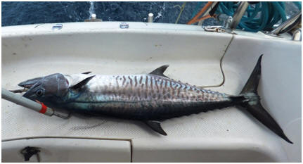
nice change from the open sea. On our way through the
reef system we caught 1.2 metre Wahoo fish that was big enough to get 6
meals out of. “Yahoo for Wahoo” I always say – as it is one of
the nicest tasting fish in my book.
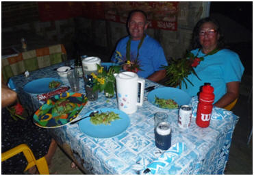
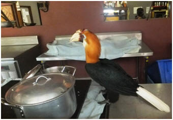 Australian
brother and sister who had grown up in PNG when their parents ran a coconut
plantation here. After finishing their education in Australia they decided
to return to the PNG lifestyle and set up this specialist surf/dive resort.
It is a small but very friendly resort with a very odd assortment of
resident local dogs and birdlife. The birds included a number of indigenous
Hornbills that helped themselves to leftovers out of the kitchen pots (see
pic), colourful red and blue Eclectics parrots, a Sulphur Crested Cockatoo
with paralysed legs that despite this s
Australian
brother and sister who had grown up in PNG when their parents ran a coconut
plantation here. After finishing their education in Australia they decided
to return to the PNG lifestyle and set up this specialist surf/dive resort.
It is a small but very friendly resort with a very odd assortment of
resident local dogs and birdlife. The birds included a number of indigenous
Hornbills that helped themselves to leftovers out of the kitchen pots (see
pic), colourful red and blue Eclectics parrots, a Sulphur Crested Cockatoo
with paralysed legs that despite this s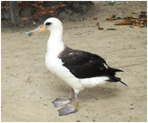 eemed
healthy and content in its pampered resort lifestyle and care. The most
unusual guest was an Albatross!! that had landed here a couple of weeks ago,
which is well off the normal flight path of these birds.
It seemed to be adapting well to its new found northerly habitat! They also
had an interesting skull and vertebrae display of a whale as a garden
feature. We enjoyed the company of the resort owners and
guests and a couple of meals here during our stay in Kavieng.
eemed
healthy and content in its pampered resort lifestyle and care. The most
unusual guest was an Albatross!! that had landed here a couple of weeks ago,
which is well off the normal flight path of these birds.
It seemed to be adapting well to its new found northerly habitat! They also
had an interesting skull and vertebrae display of a whale as a garden
feature. We enjoyed the company of the resort owners and
guests and a couple of meals here during our stay in Kavieng.
The port town of Kavieng itself is a small collection of about 4 streets with an odd assortment of general merchandise and grocery stores, a couple of banks & petrol stations, a small beachside local produce market and an airport. The main item for sale in this town seemed to be the local drug of choice – betel nut. Every few steps you took there were people selling these nuts, which is a mild narcotic and appears to be an essential part of their lifestyle. Their mouths are stained by the red jucie chewing this nut produces and globules of red spit are everywhere.
Our clearing in and out procedures here however were very low key and the easiest we have completed in all our travels. We simply had to find the customs office, which acted as immigration clearance as well. This did turn out to be a more difficult than usual as their offices were no longer at the main wharf as you expect but located in a row of office building inside the Orgin Gas depot up in the town - many of the locals did not know where it was either.
While here Matt has been working on the engine
turbo as the whine it was making was getting worse and worse. The sponge air
filter had disintegrated and parts of it sucked inside the engine which is
not a good thing!! There was also a lot of carbon clogging things up. He has
cleaned all this out and modified a car air filter to work in place of the
sponge one. The motor is sounding much better now which is a big relief to
him.
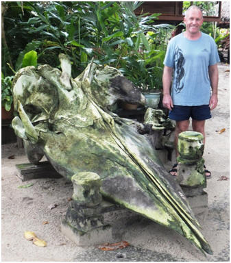
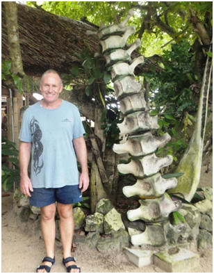

6-14th July 2012
RABAUL HARBOUR ANCHOR POSITION,
OUTSIDE YACHT CLUB: 04.12.427 S : 152.10.650 E
On leaving Kavieng we went out through Albatross Passage where the locals from Kavieng often go to hunt crocodiles. It was a narrow, but deep little passage which was quite picturesque to travel through. It also made a good short cut out into the ocean. We didn’t see any crocodiles on the way but the local villagers were intrigued to see a yacht coming through this way.
Once out in the open waters of the Gazelle channel we
had a good afternoon sail on a beam reach down to Djaul Island. We anchored
for the night in Fischer Harbour (GPS 02.58.264 South 150.57.81 East).
Fischer harbour is quite a large and deep natural harbour.
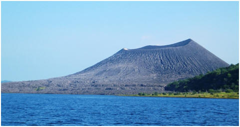 We
had to come in quite close to the internal reef to find an anchorage,
finally anchoring on the edge of a sloping coral outcrop in about 30 metres
with space to swing around (just). We were soon inundated with visitors from
the local villages who were very friendly, interactive and interested in our
yachting lifestyle and the various boat systems such as the wind generator
and solar panels. They told us there were 7 different villages in this
harbour, and they recognised our New Zealand silver fern flag and told us
how much they liked NZ. I can’t imagine any of them had actually been there,
but they seemed to have a positive image of the place. At nightfall we
thought they would go back to their villages, but they still hung around. We
felt a bit exposed and uncomfortable with this audience of local villages
while we were eating our dinner and watching a movie on the computer in the
cockpit so we eventually went below in order to get some privacy.
We
had to come in quite close to the internal reef to find an anchorage,
finally anchoring on the edge of a sloping coral outcrop in about 30 metres
with space to swing around (just). We were soon inundated with visitors from
the local villages who were very friendly, interactive and interested in our
yachting lifestyle and the various boat systems such as the wind generator
and solar panels. They told us there were 7 different villages in this
harbour, and they recognised our New Zealand silver fern flag and told us
how much they liked NZ. I can’t imagine any of them had actually been there,
but they seemed to have a positive image of the place. At nightfall we
thought they would go back to their villages, but they still hung around. We
felt a bit exposed and uncomfortable with this audience of local villages
while we were eating our dinner and watching a movie on the computer in the
cockpit so we eventually went below in order to get some privacy.
The next morning just after dawn we were awoken to the call of “Hello Island Time”, as yet another load of villagers in their canoes came visiting. I spent some time that morning chatting with some them who spoke English about our travels, and showed them on an atlas where we had been. We had a request for books, so gave away the ones that we have recently read and finished with, and also for some fishing line which we were able to help with. Matt and I then decided to go for a snorkel on the nearby reef, and even then we were accompanied but the villagers in their outrigger canoes! When we got back to Island Time we gave a hull a quick wipe down and then said our farewells to the locals before heading off again towards Rabaul.
The inner harbour is littered along it shoreline with abandoned vessels from WWII and the eruption- it would make a good junk metal yard!, As we arrived in the sheltered harbour we were called up on the VHF radio by an Australian called Steve on the yacht Viking May, welcomed to the local yacht club and told to make use the moorings outside the yacht club/ local drinking club. It all seems quite low key and friendly here with the locals were making the most of the beautiful clear blue sky day with walks along the black volcanic beach and swimming off the wharf outside the yacht club.
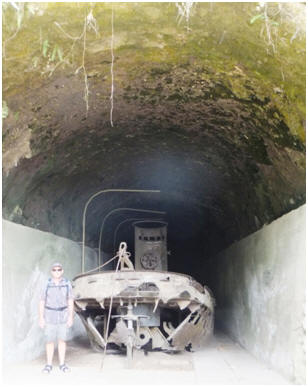 We
went ashore at sunset to check out the yacht club and see if we could get a
meal, but meals were only served on Friday nights. We meet Ron the skipper
of the motor launch Barbarian tied up at the wharf. He is an ex-pat Aussie,
but has lived in Rabaul for the past 20 years. He does a lot of diving and
charters on his boat. Apparently he is a world expert on aircraft wreck
location and diving, and his services have been in demand around the world
in this area. He was very obliging and helpful in providing information
about Rabaul and the local area, and gave us advice on where to find things
and what to see. He had some advanced towed array sonar to
help locate aircraft, and some interesting sonar pics of various aircraft
including zeros, b25’s etc.
We
went ashore at sunset to check out the yacht club and see if we could get a
meal, but meals were only served on Friday nights. We meet Ron the skipper
of the motor launch Barbarian tied up at the wharf. He is an ex-pat Aussie,
but has lived in Rabaul for the past 20 years. He does a lot of diving and
charters on his boat. Apparently he is a world expert on aircraft wreck
location and diving, and his services have been in demand around the world
in this area. He was very obliging and helpful in providing information
about Rabaul and the local area, and gave us advice on where to find things
and what to see. He had some advanced towed array sonar to
help locate aircraft, and some interesting sonar pics of various aircraft
including zeros, b25’s etc.
On my bday we went out to visit the remains of an underground hospital the Japanese built here in WWII and a big tunnel they constructed to house 7 landing craft barges in a hillside beside the sea so they would not be seen by the allies. Also Ron from the motor launch let me use his small washing machine – this was a real treat not having to do handwashing! I made the most of the opportunity getting our outside squab covers washed which were overdue for a cleanup and look much brighter again.
While at Rabaul we did a walk up behind the town to the Japanese Peace gardens and lookout point, which gave you a great overview of the harbour, and view of the destruction to ‘old Rabaul’ by the volcano over to the newly built area of the town. We also did a trip down Kokopo about 20 kms away, which is the township and government centre that was built after the eruption to replace Rabaul. Matt was keen to find a computer/electronic store that might have some shielded data cable. He has spent some more time the last few days working on our radar issue and now thinks the faulty issue is mainly to do with the cabling. He didn’t quite what he wanted but got something that he thought might do, and did manage to get the radar working again for a short while. However it won’t stay powered on for a reliable period of timing and keeps switching off. At least we again have something to use to check chart accuracy if we are uncertain about an area.
By the 14th of July the forecast indicated the conditions for the next few days would be a weather calm window opened up that would suit our onwards passage to the Solomon Islands. We were ready to leave behind the sleepy harbour of Rabaul and the fine volcanic ash that still covers it, and now our boat as well. We refuelled and stocked up on fresh supplies, and completed the official clearing out documentation for Papua New Guinea, which was once again was a very easy and quick process.

14-17th July 2012
The sky that evening as we passed small islands
with breaking surf on the reefs around them.
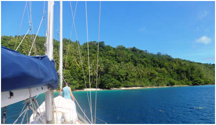 As
indicated by the weather forecast, on our first day out after leaving Rabaul
we had reasonably light winds with a slight sea state. Our planned course
took us across the narrow gap of the Solomon Sea from New Britain Island to
the bottom of New Ireland Island. This meant we were heading into the
prevailing wind in this area, and with the light conditions we could still
make good progress motor-sailing along the coastline without using a lot of
fuel. Matt was pleased to get through this area which is known for currents
flowing against you of up to 4 knots at times. Late afternoon we found a
delightful anchorage spot in sand near the beach in the passage behind
Lombom Island (GPS 04.47.882 South 152.51.507 East). This
area is quite cultivated, well-maintained and populated settlement. The
locals called out friendly greetings to us, and we soon had visitors in
their local dugout canoes. One elderly man called William told us how he had
made a very a good New Zealand friend when working as a mechanic alongside
him in the Papua New Guinea mines. He introduced us to his sons and grandson
who had also come out to visit us and told us we were most welcome to stay,
and would be very safe here. He asked if we had any spare fishing hooks,
which we supplied him with along with some fishing line.
As
indicated by the weather forecast, on our first day out after leaving Rabaul
we had reasonably light winds with a slight sea state. Our planned course
took us across the narrow gap of the Solomon Sea from New Britain Island to
the bottom of New Ireland Island. This meant we were heading into the
prevailing wind in this area, and with the light conditions we could still
make good progress motor-sailing along the coastline without using a lot of
fuel. Matt was pleased to get through this area which is known for currents
flowing against you of up to 4 knots at times. Late afternoon we found a
delightful anchorage spot in sand near the beach in the passage behind
Lombom Island (GPS 04.47.882 South 152.51.507 East). This
area is quite cultivated, well-maintained and populated settlement. The
locals called out friendly greetings to us, and we soon had visitors in
their local dugout canoes. One elderly man called William told us how he had
made a very a good New Zealand friend when working as a mechanic alongside
him in the Papua New Guinea mines. He introduced us to his sons and grandson
who had also come out to visit us and told us we were most welcome to stay,
and would be very safe here. He asked if we had any spare fishing hooks,
which we supplied him with along with some fishing line.
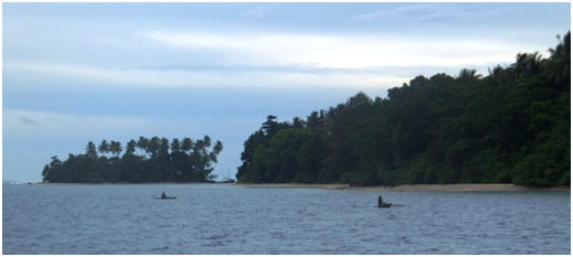 We
left at sunrise the next morning and got some tidal assistance out of the
passage with a nice 12 knot breeze from behind to help us sail along.
Unfortunately the breeze did not last and came down to 2 knots, so it was
time to start the motor yet again so we could continue our progress. The
wind came around to head on later in the morning day with a 1.5 metre wave
chop, and overcast squally conditions slowed out progress further. We pulled
in behind Torakina Island to anchor (GPS 06.14.501 South 155.01.827 East)
for the night and got out of the sloppy sea state. I had a quick snorkel
along the reef beside the island before sunset and we had visitor from a
nearby village in his newly made outrigger
We
left at sunrise the next morning and got some tidal assistance out of the
passage with a nice 12 knot breeze from behind to help us sail along.
Unfortunately the breeze did not last and came down to 2 knots, so it was
time to start the motor yet again so we could continue our progress. The
wind came around to head on later in the morning day with a 1.5 metre wave
chop, and overcast squally conditions slowed out progress further. We pulled
in behind Torakina Island to anchor (GPS 06.14.501 South 155.01.827 East)
for the night and got out of the sloppy sea state. I had a quick snorkel
along the reef beside the island before sunset and we had visitor from a
nearby village in his newly made outrigger
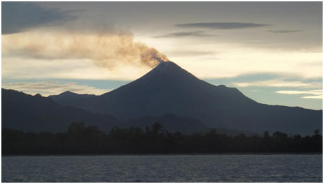 we could assist the logistics of this wish without an upfront payment and
contact details. Matt stated later that he has been quite surprised about
the requests for items from local the local Papua New Guinea people. We have
also had requests for snorkel gear and GPS, solar panels, binoculars,
outboards etc. They obviously see us as potential goods suppliers.
we could assist the logistics of this wish without an upfront payment and
contact details. Matt stated later that he has been quite surprised about
the requests for items from local the local Papua New Guinea people. We have
also had requests for snorkel gear and GPS, solar panels, binoculars,
outboards etc. They obviously see us as potential goods suppliers.
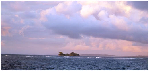
It has been a feature of our passages thorough
PNG waterways that we have seen very little other boating traffic of any
kind. After
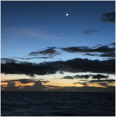 the
busy waterways of Indonesia and Malaysia it has seemed quite desolate.
However as we entered the channel between PNG and the Solomon’s we did see
some shipping and fishing vessels. Around 2am the conditions calmed off and
at 4am when I came on watch I witnessed an unusual sight of the moon rising
in the sky, followed about 15 mins later with the breaking of the dawn sky.
the
busy waterways of Indonesia and Malaysia it has seemed quite desolate.
However as we entered the channel between PNG and the Solomon’s we did see
some shipping and fishing vessels. Around 2am the conditions calmed off and
at 4am when I came on watch I witnessed an unusual sight of the moon rising
in the sky, followed about 15 mins later with the breaking of the dawn sky.
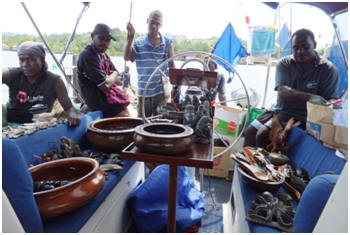 pour
with rain making it very difficult to see the entrance. The chart for this
area turned out to be off in position by 1/3 mile making it difficult to
navigate in the narrow entrance. We wished the radar still worked properly
again! However we safely arrived and anchored inside the port beside two
other yachts at around 3pm. We were no sooner anchored than we were
approached by locals wanting to sell us wood and stone carvings that they
are renowned for in this area. We tell them we want to quickly head into
town to catch the port officials before they go home. The carvers show us
where to go, but we had forgotten that we have moved forward one hour in
time zones and they are all ready gone for the day. We went back to the
dingy dock at the yacht club and enjoyed a drink, and meal of fish and
chips.
pour
with rain making it very difficult to see the entrance. The chart for this
area turned out to be off in position by 1/3 mile making it difficult to
navigate in the narrow entrance. We wished the radar still worked properly
again! However we safely arrived and anchored inside the port beside two
other yachts at around 3pm. We were no sooner anchored than we were
approached by locals wanting to sell us wood and stone carvings that they
are renowned for in this area. We tell them we want to quickly head into
town to catch the port officials before they go home. The carvers show us
where to go, but we had forgotten that we have moved forward one hour in
time zones and they are all ready gone for the day. We went back to the
dingy dock at the yacht club and enjoyed a drink, and meal of fish and
chips.

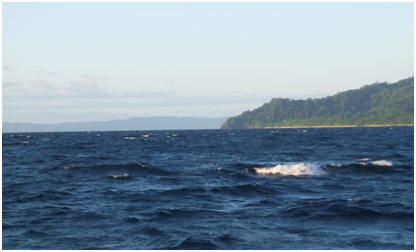 Pef
in the group of Islands west of Papua known as Raja Ampat. It was the first
passage we have made in months where we actually got to sail for several
hours without using the motor and had whitecaps– a real novelty after the
last few months of calm and windless conditions. In the wee hours of the
morning we had a small problem with the hydraulic steering system when one
of the main steering bolts came loose which meant the autopilot was unable
to hold its course. Matt was able to easily remedy this problem by
retightening the bolt that after months of use works its way loose.
Pef
in the group of Islands west of Papua known as Raja Ampat. It was the first
passage we have made in months where we actually got to sail for several
hours without using the motor and had whitecaps– a real novelty after the
last few months of calm and windless conditions. In the wee hours of the
morning we had a small problem with the hydraulic steering system when one
of the main steering bolts came loose which meant the autopilot was unable
to hold its course. Matt was able to easily remedy this problem by
retightening the bolt that after months of use works its way loose.

10-14th June 2010
PEF ISLAND GPS
POSITION 0.26.523 S : 130.26.612 E
Having received a strong
recommendation about this place via another yacht that
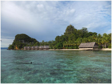 were
very keen divers, we approached the beach side of the island but found it
was too deep and steep-to to anchor in this location. The owner of the
resort, a Swiss lady named Meya, came aboard and gave us directions to a
very sheltered anchorage around the back of the island that we would never
have found by ourselves. You entered between two large rock formations,
which then opened up into a very sheltered lagoon with branches of waterways
coming off it in numerous directions. We anchored in 25metres at the head of
the bay close to the jetty and boardwalk, which meanders through the
mangroves up to the beach front resort location.
were
very keen divers, we approached the beach side of the island but found it
was too deep and steep-to to anchor in this location. The owner of the
resort, a Swiss lady named Meya, came aboard and gave us directions to a
very sheltered anchorage around the back of the island that we would never
have found by ourselves. You entered between two large rock formations,
which then opened up into a very sheltered lagoon with branches of waterways
coming off it in numerous directions. We anchored in 25metres at the head of
the bay close to the jetty and boardwalk, which meanders through the
mangroves up to the beach front resort location.
Once Jim and Joy from the Yacht
Kelaran were safely anchored in here as well, Joy and I were eager to
explore this environment and check out the snorkelling which we had heard
such positive reports about. The Raja Ampat islands and West Papua region is
very isolated and unpopulated which has left the environment largely
untainted by civilisation. Local tribes are still living off the land, and
the natural biodiversity of the sea and landscape is claimed to be one of
the most diverse and fascinating in the world. There is a careful
conservation and education management plan in place that works with the
local inhabitants to maintain and preserve this special area with its
unprecedented variety of marine habitat. It forms part of the coral triangle
and is endowed with nourishing ocean currents that transverse the region,
causing the area to flourish as an abundant incubator for the huge variety
of species you can find here. The underwater world is
certainly the most impressive we have seen in all our travels and lives up
to its reputation as a premier dive location. You feel like you are swimming
through the pages of photographic dive book-it’s so good.
This small eco-resort
at Pef Island ( www.raja4divers.com)
was officially closed while we were here however Meya and staff still
welcomed us and were most
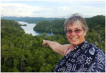 obliging
and made us feel at home. They certainly live up to their moto of “arrive as
a guest, live like a king, leave as a friend”. The resort building and
bungalows are constructed out of natural/local materials and tastefully and
aesthetically scattered throughout. They also have a dedicated camera studio
for hiring underwater camera gear and processing you pictures, a petanque,
obliging
and made us feel at home. They certainly live up to their moto of “arrive as
a guest, live like a king, leave as a friend”. The resort building and
bungalows are constructed out of natural/local materials and tastefully and
aesthetically scattered throughout. They also have a dedicated camera studio
for hiring underwater camera gear and processing you pictures, a petanque,
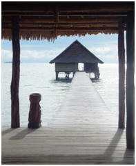 volleyball,
giant chess set, a small library and games area in the dining room along
with a resident local carver who helps repair/maintain the resort buildings
and has a studio with interesting carvings for sale. Matt and Jim from
Kalaren worked on the resort ham radio that they use to talk with their dive
boats with and had been having issues with. They left them with some ideas
for sorting out the problems.
volleyball,
giant chess set, a small library and games area in the dining room along
with a resident local carver who helps repair/maintain the resort buildings
and has a studio with interesting carvings for sale. Matt and Jim from
Kalaren worked on the resort ham radio that they use to talk with their dive
boats with and had been having issues with. They left them with some ideas
for sorting out the problems.

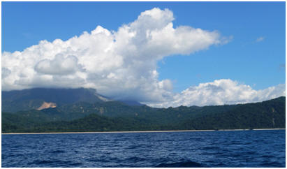
From the Raja4divers resort of Island of Pef we made our way down the coast of West Papua to our clearing our port for Indonesia at the island of Biak in a series of day/overnight hops. We had some lovely sunrises and sunsets to begin and end our days and a mix of sailing and motorsailing in reasonably light easy passage making conditions.
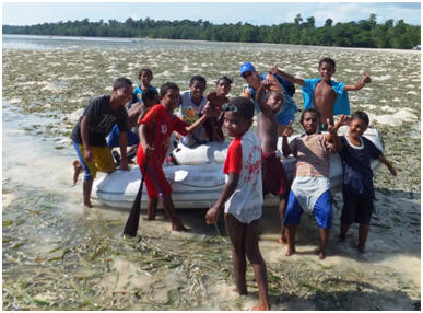 Our next stop was at the Island of Amsterdam that was
listed in the dive
Our next stop was at the Island of Amsterdam that was
listed in the dive
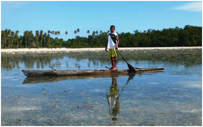 school
and over a hill to the next village. One of the older children spoke quite
good English, whilst the rest simply enjoyed practicing the words they did
know or repeating the words we used. They also sang various English songs
they knew as we traipsed along the paths. We passed on some clothing and
some pens and paper to the village elders in appreciation
school
and over a hill to the next village. One of the older children spoke quite
good English, whilst the rest simply enjoyed practicing the words they did
know or repeating the words we used. They also sang various English songs
they knew as we traipsed along the paths. We passed on some clothing and
some pens and paper to the village elders in appreciation
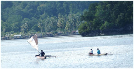
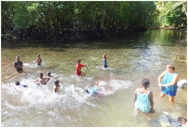
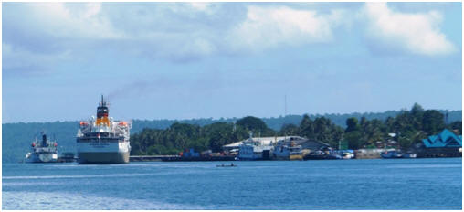 BIAK
PORT
BIAK
PORT
_____________________________________________________________________


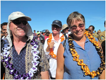
Following a two day/overnight passage
we reached the next rally destination of Morotai, at the Northern end of the
Maluku Island Group of Indonesia. I hadn’t been much assistance on the way
over as I suffered from some sort of 24 hour vomiting and diarrhoea bug that
laid me low, but fortunately the conditions were smooth and easy.
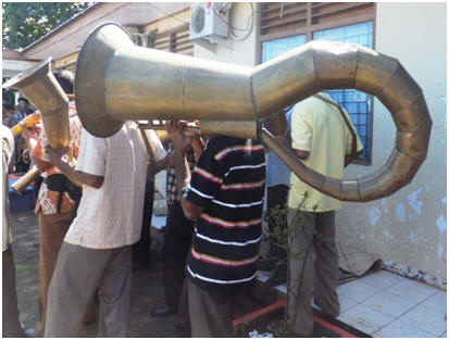 The
yachties were encouraged to participate in and learn these dances, which
caused much hilarity amongst the locals! Other trips around the island
included a visit to a local village that made a type of Ketchup which they
showed us how they make from some local ingredients (see pic below). We were
also taken on a number of tours of WWII relics, as Morotai was a significant
airfield base during WWII when the USA and allied forces were attempting to
overturn the invasion of the Japanese invasion into the pacific region.
The remaining relics have that have not stood up well to the
test of time and while significant during their time, are now beyond
redemption and of not much value or interest to most of us in their current
state nearly 70 years on.
The
yachties were encouraged to participate in and learn these dances, which
caused much hilarity amongst the locals! Other trips around the island
included a visit to a local village that made a type of Ketchup which they
showed us how they make from some local ingredients (see pic below). We were
also taken on a number of tours of WWII relics, as Morotai was a significant
airfield base during WWII when the USA and allied forces were attempting to
overturn the invasion of the Japanese invasion into the pacific region.
The remaining relics have that have not stood up well to the
test of time and while significant during their time, are now beyond
redemption and of not much value or interest to most of us in their current
state nearly 70 years on.

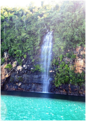
13-20th May 2012
It was a two day sail with mixed weather down from Morotai
to Jailolo, with stops at a bay/fishing village at the top of Halamera, and
then the stunning Loloda bay with its backdrop of volcano’s and waterfalls
tumbling down hillsides straight into the sea along with a lovely assortment
and variety of coloured coral to view in the water. It was rather a special
location and a shame we didn’t have time to stay here longer and investigate
it all further before we had to head off to our Jailolo rally stop.
very sheltered but very shallow and surrounded by coral
shelves with not a lot of room for anchoring so we ended up rafting up as a
group of seven boats to fit in. A raft-up makes for very social living
conditions so we enjoyed sunset drinks on deck most evenings on one of the
larger yachts “Ingrid of the Isles.” Our yachts act as part of the backdrop
to the main stage for the festival, and so we got to hear the celebrations
taking part on the stage behind us each evening until the shutdown at
midnight each night and then when they restarted again around 6.30-7am in
the morning!
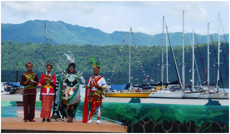
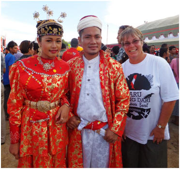
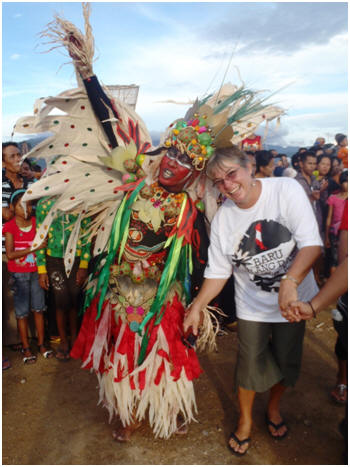
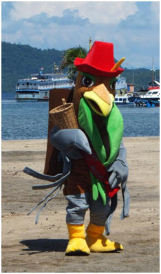
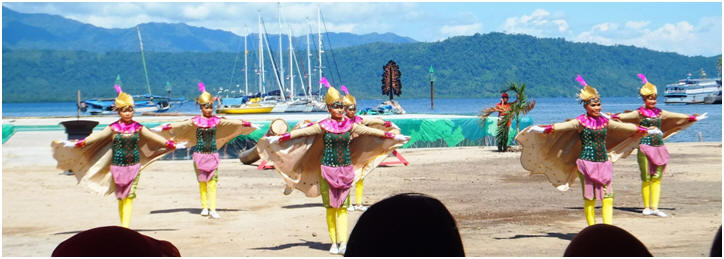
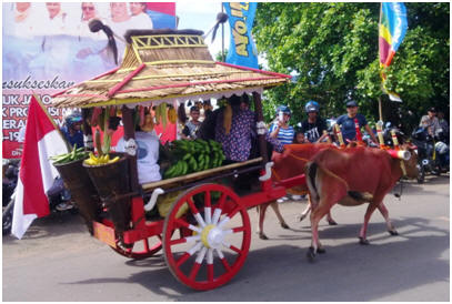
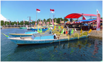
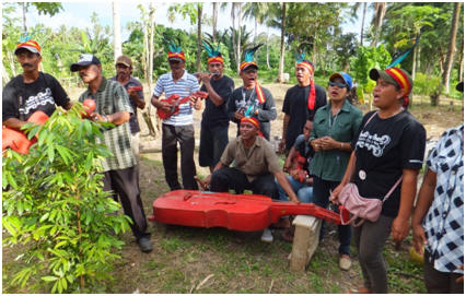
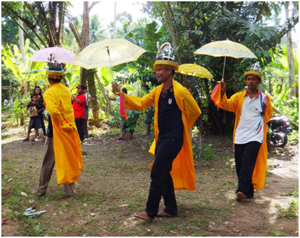
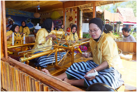

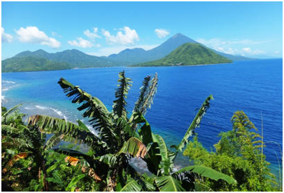
21-25 May 2012
Just a short afternoon day sail of
20 nautical miles took us from Jailolo to the next rally stop of Ternate.
Ternate is the main city and transportation hub for this region, and is
picturesquely surrounded by a ring of perfectly shaped volcanic islands (see
pics), that make for a stunning backdrop. Our stay here was well organised
by the local guides/tourism office, and it was also where we had to complete
the necessary documentation to obtain an extension for our Indonesian visas
for one more month.
During our time here we were taken
on tours around this volcanic island to view the remains of Dutch and
Portuguese fortresses built here during the 1500-1600’s. Got to visit the
local Sultan’s Palace that was built in 1796, and were
generously hosted by the regions Governor at various local restaurants to
sample local dishes. He also organised a speed boat trip, along with an
escort of four security policemen on jet-skis to his residence across the
bay for afternoon tea, and then to see the stunning sunset view from his
deck! This was all part of a media publicity event, to showcase the “Sail to
Indonesia Rally” visit to the region, for which we had to endure numerous
photo shoots along and video recorders documenting our thoughts and
impressions of our trip – a small price to pay for the generous hospitality
we have enjoyed.
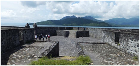
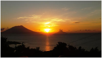
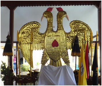
Other outings included a visit to a
lava/volcanic rock flow that in the most recent eruption in 1994, had wiped
out numerous homes and killed a number of people. We had a
snorkelling trip to a local beach which had a lovely clear blue water bay
and lagoon, where freshwater poured water out of the hillside. The coral and
fishlife were quite good to swim around in. We also got to see some
interesting inland sunken volcano crater lakes that are now used by local
people for recreation and fresh fishing farms. The local tourism office did
a great job here of showcasing many of the areas highlights for us, and were
well organised, flexible to the yachties needs and as efficient as the
Indonesian concept of “Rubber Time” allows!
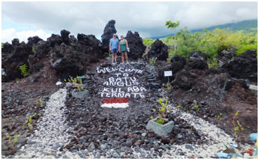
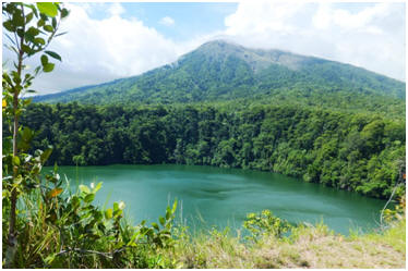
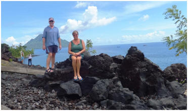
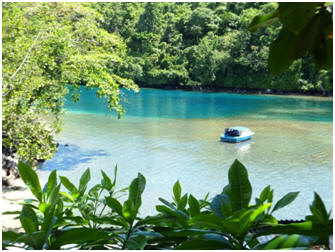
Ternate also had a recently built
“shopping mall”, with a good supermarket which enabled us to top up
supplies, including a bakery with decent wholemeal bread which is a rare
community in Indonesia. The mall also had a great Pizza
outlet that we enjoyed a couple of meals out at, and a good coffee shop. We
also found a restaurant that served lamb and steak which is a rare find in
this area. It was nice treat for our taste buds to have some western style
food again, as we were getting rather tired of local cuisine by this stage
in our travels. The big local fruit and vege market had a good range of
produce as well to resupply with before we headed off again.
Whilst we were here in Ternate, Matt received the Volvo fresh water engine pump that had been flown in from New Zealand, along with some parts for our 15 horse dingy outboard motor. He was now able to properly replace the pump (after making a temporary engine modification to allow a salt water cooling back in Manado a few weeks ago). He was very pleased to have the engine running on fresh water again, and it is good to have our larger dingy motor going again as well.
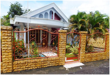
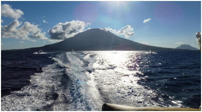

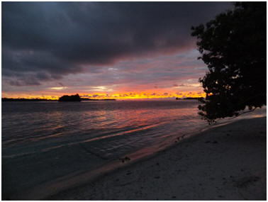
26th
May-2nd June 2012
The rally timetable over this week,
allowed for some well needed quiet rest and relaxation stops in the south
Malaka/Halmahera area, away from the rally obligations and organisation of
the last few weeks. Our first stop was the pretty little island of Gura Ici.
Just before we arrived at Gura Ici we crossed over the equator
and passed back into the Southern Hemisphere.
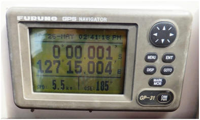
At Guri Ici we anchored over the
coral reef in sand, and enjoyed snorkelling the reef from our yachts. Ashore
was a small village that gave us a welcome ceremony, showed us their weaving
talents and cooked a meal for us on the beach.
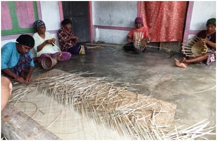
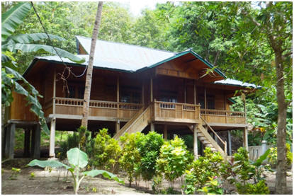
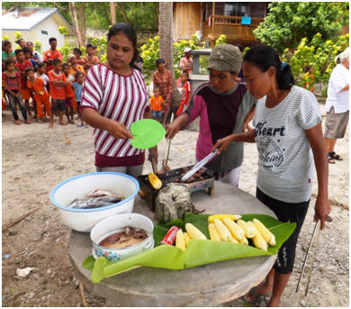
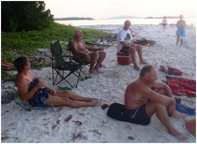
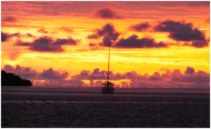

2-7th
June 2012
We had been forewarned by another
yacht that had come in ahead for a dental checkup that the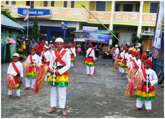 official
designated anchorage outside of the main township was untenable due to the
current local wind and wave conditions. They had relocated to a nearby
island that offered much better shelter and protection, the only issue was
it was very deep up close to the island and many of the yachts carried
insufficient anchor chain to stay in this location. We stayed out at the
island with two other yachts and were quite comfortable, although it did
require a 10 minute speed boat ride to get into town. The others took their
boats in to the requested anchor point, but it was not viable to stay on
onboard with their boats rolling heavily from side to side in the waves.
Instead they arranged with the rally organisers to obtain rooms at a local
hotel until things settled down.
official
designated anchorage outside of the main township was untenable due to the
current local wind and wave conditions. They had relocated to a nearby
island that offered much better shelter and protection, the only issue was
it was very deep up close to the island and many of the yachts carried
insufficient anchor chain to stay in this location. We stayed out at the
island with two other yachts and were quite comfortable, although it did
require a 10 minute speed boat ride to get into town. The others took their
boats in to the requested anchor point, but it was not viable to stay on
onboard with their boats rolling heavily from side to side in the waves.
Instead they arranged with the rally organisers to obtain rooms at a local
hotel until things settled down.
It was quite a wet week during our
stay here, but we had fun and once again we were treated like royalty by the
locals. Following the formal welcome ceremony we were invited to complete a
tour of the city using the local form of hire transportation – bicycles that
have a bench type seat and canopy at the front.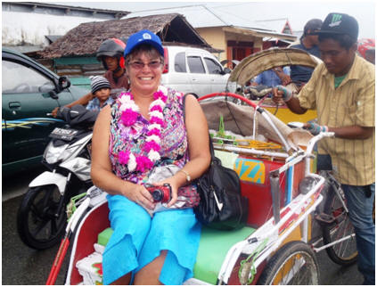
Part of the tour included
visiting a 15th century Portuguese fort that is still in
remarkably good condition. Other tours of the local environment included
going out to a former rubber tree plantation that has been turned into a
reserve with pathways and a number of gazebo shelter structures. Sadly while
this could be a peaceful, cool and relaxing picnic type place it has not
been maintained with the pathways littered and slippery with leaf debris,
and most of the structures now rotted out. Other tours included a visit to
the local Sultan’s residence; being hosted at the Regents office for lunch
that has a superb outlook over the town and harbour, a visit to a local
primary school were we were inundated with children wanting to practice
their limited English with us and obtain our signatures. We
were also taken to local gemstone manufacturers that make jewellery from the
local precious stone known as Bacan (which is similar to Jade or
Greenstone). One afternoon we were taken to a nearby village for a
delightfully refreshing swim at the local swimming hole at the Amazing
River. It was a very pleasant change to swim in fresh water again, and
afterwards we were supplied with fresh drinking coconuts by the locals.
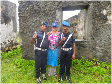
During our stay in Labuha the town
was busy getting geared up for their local anniversary celebrations.
A large marching competition seemed to form a big part of the event
with groups from all ages represented. It is obviously a focus of the local
lifestyle here. They all looked very smart in their brightly coloured
uniforms as they marched through the streets.
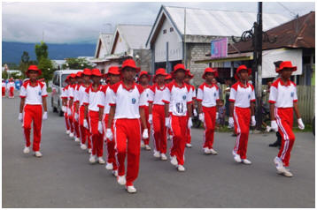 Labuha
was our last official rally stop with the group of yachts that we have been
travelling with for the last few months. From here most of the group will
continue through Indonesian waters to Darwin. There are 2 of us are heading
up towards Papua New Guinea and back through the pacific islands then to NZ,
and one boat is travelling back to America. It has been good mixing and
mingling with this group of yachties, and the assistance of the rally
organisation is a considerable advantage when travelling through Indonesia
by yacht to ease the complex paper trail and bureaucracy.
Labuha
was our last official rally stop with the group of yachts that we have been
travelling with for the last few months. From here most of the group will
continue through Indonesian waters to Darwin. There are 2 of us are heading
up towards Papua New Guinea and back through the pacific islands then to NZ,
and one boat is travelling back to America. It has been good mixing and
mingling with this group of yachties, and the assistance of the rally
organisation is a considerable advantage when travelling through Indonesia
by yacht to ease the complex paper trail and bureaucracy. 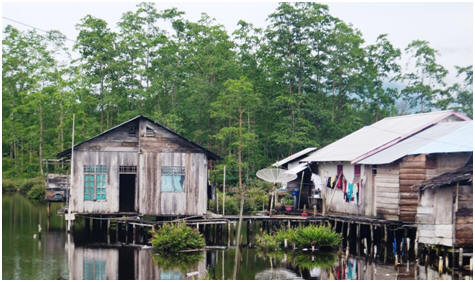
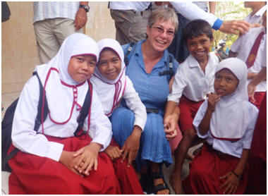

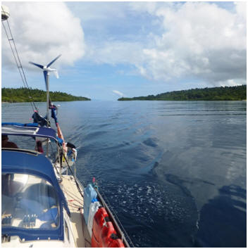
7-9th June 2012
With our official rally commitments
over we had a day sail further down the coast of Halamera to a sheltered
little bay/anchorage stop where we intended to have a private farewell beach
party with just our small group of rally yachts before we split up and
headed in different directions after leaving the bottom of this Island
group. It has been fun meeting a new group of
people some of who we hope will come to visit us in NZ at some stage, and
some who we may at some stage see in their home ports after we have earned
some money again back in NZ and can do more travels.
The following day the majority of
the group headed off early to make the most of conditions for their onwards
passage towards Darwin, however just as they were leaving the bay the
weather closed in and it started to pour with rain. We decided to delay our
departure by a couple of hours and wait for this front to pass over. We only
planned to do a short day sail down to a couple of islands at the bottom of
this region, where we would wait up for the wind to turn to a better angle
for sailing across to West Papua in the next day or so as was indicated in
the forecast.
We found a very sheltered passage
between two islands to anchor in for the night and the next morning enjoyed
a snorkel along the coral reef shelf between the two islands before we
headed off to meet up with the crew on the yacht Kalaren who were anchored
at the next island up, and with whom we planned to travel with across to
West Papua (Indonesian Iran Jaya) with. We gave the hull of Island Time a
quick clean here to help make her slip through the water faster for the
upcoming passage. Then in the afternoon the breeze started to fill in from
the direction we wanted and was making conditions in this anchorage not so
pleasant, so time to head to across towards West Papua (Indonesian Irian
Jaya).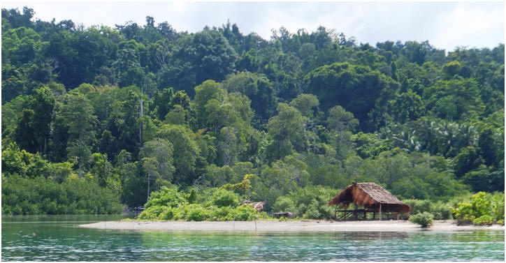

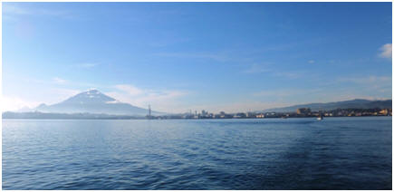
1-3 May 2012
On our way to Manado the fresh water cooling pump Matt had concerns about in Kwandang failed completely, leaving us without a useable engine. Matt with the assistance of Wayne (from the yacht Court Jester –a retired diesel mechanic)were able, after a couple of hours work as we bobbed around on the sea, to modify the engine and convert it to salt water cooling system as a temporary stop-gap measure until we can get the replacement part. The modification meant however that our alternator was now unusable until we could locate and purchase a different size belt that would work with the modification. Therefore in the meantime we had a limited power supply for our instruments, auto-pilot and fridge/freezer unit - though we should have enough in our batteries to get us to Manado overnight.
That afternoon I took Matt and Mako from
the yacht “Viva Layla” who also has been unwell for a number of days to the
local hospital to be checked out, and to get Malaria blood tests completed as
recommended in our medical guide. Fortunately the blood tests showed them not to
have Malaria, however they were quite keen for Matt to stay overnight with his
high temperatures, but this hospital was not a place you wanted to linger! Our
white faces were quite the novelty factor in this place with numerous requests
for photos’ from young nursing staff (just what you want when not feeling
well!), and also as this being a predominately Christian region several locals
came up and offered prayers for Matt – an indication of how unwell he looked.
Overall the staff were extremely helpful and obliging in trying to meet our
needs.
After another days work with help from
other yachties Matt managed to get our charging system working on Island Time,
he also spent more time on the yacht ‘Ingrid of the Isles’ resolving the
alternator and wiring issues for them. I restocked the boat – as the supermarket
here was good and we got some decent bread
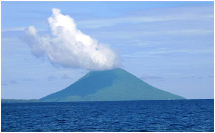 from
a Dutch Bakery.
from
a Dutch Bakery.
Following the advice of one of the locals I took the opportunity to view the coral on the reclamation boulders behind where our yachts were anchored. It was a healthy sign to see coral growing in this location right on the edge of a main town. With boat jobs completed it was time to head north to the resort island of Bangka at the top of Sulawesi for a well overdue recreational break before our next passage up to the Maluku Group of Islands. It was an easy ½ day trip up to here, passing by a number of small islands and volcano’s rising straight out of the sea on our way up the coastline. After anchoring in the strong current running round the island we went ashore and spent a lazy afternoon by the pool. I enjoyed a massage early evening and this was followed by a very enjoyable but somewhat late dinner at the resort to finish the day off with. The following day we begin our passage over to the Maluku Group of Islands.
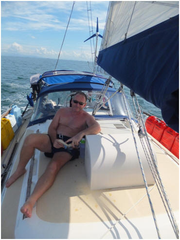

We left Tarakan, Kalimantan, Indonesia to head across the Makassar Strait to the Indonesian island of Sulawesi. This trip over the last week has been with incredibly easy conditions - calm seas, blue skies and starry nights.
After leaving the big rivers of Kalimantan with the debris of rubbish, trees and logs it has been a pleasure to be back to ‘blue water’ sailing. However due to the lack of wind as we are in the ‘doldrums’ territory just a few degrees North of the equator, we have only had a couple of hours of true sailing in the last week. It has mostly been motor assisted sailing, with the engine ticking over on low revs. The seasonal current running along the coast gives us up to 1.5 knots of assistance at times, which is an added bonus.
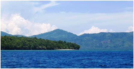 It did not appear to be aware of our impending approach showed no signs of
moving so we had to do a 90 degree sudden course to avoid a collision with this
incredible 40 foot specimen. Just at that moment it came to life
just and dived down off our port side. A thrilling and scary event all at the
same time!
It did not appear to be aware of our impending approach showed no signs of
moving so we had to do a 90 degree sudden course to avoid a collision with this
incredible 40 foot specimen. Just at that moment it came to life
just and dived down off our port side. A thrilling and scary event all at the
same time!
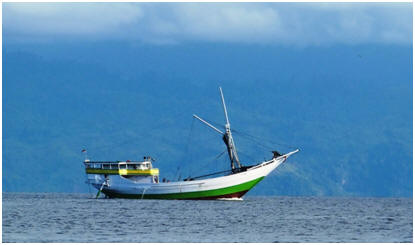 to
lift up and down and with only the two of us and not a whole family using the
dingy these days the smaller motor is quite suitable for our current needs
whilst also being much more fuel efficient and environmentally friendly. Matt
has modified the outboard so it has a tilt and lock mechanism for lifting the
motor over shallow coral reefs, a feature the bigger outboards come with.
to
lift up and down and with only the two of us and not a whole family using the
dingy these days the smaller motor is quite suitable for our current needs
whilst also being much more fuel efficient and environmentally friendly. Matt
has modified the outboard so it has a tilt and lock mechanism for lifting the
motor over shallow coral reefs, a feature the bigger outboards come with.
We are enjoying the company of the 5
other rally boats we are currently in convoy with. It is interesting to meet new
people, hear new stories and ideas as well as viewing other boats.
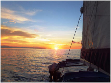 We’ve
had a mix of overnight passages and day sails with some stunning sunsets to
watch as we end each day.
We’ve
had a mix of overnight passages and day sails with some stunning sunsets to
watch as we end each day.
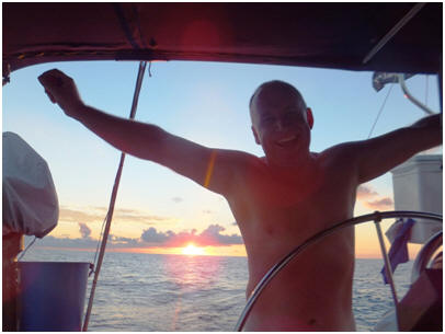 to
transport the jerry cans in, but even so two trips were still necessary and it
took the rest of the day to complete the task.
to
transport the jerry cans in, but even so two trips were still necessary and it
took the rest of the day to complete the task.
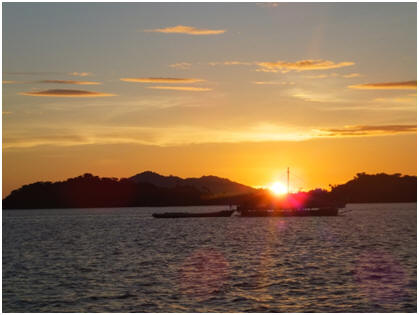 enabling them to get underway again. The charging system however proved more
complex, and after working on it all afternoon with no success the decision was
made to do some more work on it when we arrived at Manado, which is the main
town of Northern Sulawesi that we are headed to next.
enabling them to get underway again. The charging system however proved more
complex, and after working on it all afternoon with no success the decision was
made to do some more work on it when we arrived at Manado, which is the main
town of Northern Sulawesi that we are headed to next.
Matt was shattered and
exhausted after a full day in the heat of engine rooms and
being a dirty, greasy, sweaty engine bilge rat! That evening he was suffering
from flu like symptoms, with a high temperature fever, cold shivers and aches
and pains. Although we thought it was probably a bout of the flu
that is currently doing the rounds of the boats we took the added precaution of
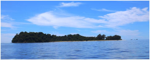 vege
supplies that we were running short of by this stage. Our looks and presence is
quite unusual in this part of the world, they are particularly intrigued with
our long noses, compared to their squat ones. We had lots of requests for photo
stops and with the use of a phrase book and the assistance of some locals who
spoke a little English we managed to make ourselves understood.
Everyone was so friendly helpful and accommodating.
The next morning Matt was feeling considerably better and so at sunrise the
fleet headed off towards Manado –another overnight sailing passage.
vege
supplies that we were running short of by this stage. Our looks and presence is
quite unusual in this part of the world, they are particularly intrigued with
our long noses, compared to their squat ones. We had lots of requests for photo
stops and with the use of a phrase book and the assistance of some locals who
spoke a little English we managed to make ourselves understood.
Everyone was so friendly helpful and accommodating.
The next morning Matt was feeling considerably better and so at sunrise the
fleet headed off towards Manado –another overnight sailing passage.

18-22nd
April 2012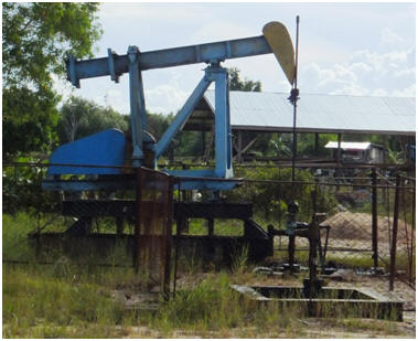
Hello from Tarakan, our first official “Downunder Rally” stop. Tarakan is small oil rich border town, the seascape is dotted with oil rigs, and on land small “donkey style “oil pumps appear everywhere. We arrived late afternoon but had to wait for all the officials to come and clear our boat – 12 people in total on our little boat clambering everywhere! We had forgotten what a novelty we are as “white faced yachties” to the locals and they all wanted photos of us and the boat. Our “Downunder Rally” organizer had everything sorted for us with officialdom so no problems there and when we got ashore nibbles and drinks provided as we were all hot and tired in this doldrums area.
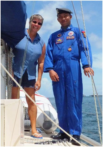 I
have been feeling extremely hot and bothered the last couple of days, and a bit
run down I think with an ear infection, on top of this I came out
in a sweat rash/prickly heat, and ulcers all over my tongue. The last few stops
in Malaysia had been rushed stops with lots of heavy lifting of fuel and
water/groceries onto the boat my shoulders and neck sore were aching as well.
Matt has been having haemorrhoid issues again, is itchy from bites and had lots
of boat jobs to do again recently in the heat - so we were both feeling a bit
irritated with each other. Anyway I read up my Ships Doctors book about prickly
heat which recommended “removing patient to an air-conditioned room”, and for my
arthritic neck and shoulder rest so decided that when we arrived here it was
time for a “boat holiday” and some down time in the cool of a hotel along with a
visit to a Doctor. The sailing rally organizer (Raymond Lesmana) sorted a hotel
for us. Very comfortable -big bed, cool room, nice food and I had a massage the
1st night so slept much better. We went to the Doctor the next morning, both of
us coming away with medication. He recommended I will need to see an ear
specialist again when we get back to NZ, as I have been having lots of on-going
issues in this department in recent months. Another night here in the hotel and
perhaps we will be both feeling happier.
I
have been feeling extremely hot and bothered the last couple of days, and a bit
run down I think with an ear infection, on top of this I came out
in a sweat rash/prickly heat, and ulcers all over my tongue. The last few stops
in Malaysia had been rushed stops with lots of heavy lifting of fuel and
water/groceries onto the boat my shoulders and neck sore were aching as well.
Matt has been having haemorrhoid issues again, is itchy from bites and had lots
of boat jobs to do again recently in the heat - so we were both feeling a bit
irritated with each other. Anyway I read up my Ships Doctors book about prickly
heat which recommended “removing patient to an air-conditioned room”, and for my
arthritic neck and shoulder rest so decided that when we arrived here it was
time for a “boat holiday” and some down time in the cool of a hotel along with a
visit to a Doctor. The sailing rally organizer (Raymond Lesmana) sorted a hotel
for us. Very comfortable -big bed, cool room, nice food and I had a massage the
1st night so slept much better. We went to the Doctor the next morning, both of
us coming away with medication. He recommended I will need to see an ear
specialist again when we get back to NZ, as I have been having lots of on-going
issues in this department in recent months. Another night here in the hotel and
perhaps we will be both feeling happier.
We came briefly back out to the boat last night to
get some things, only to discover the freezer did not work! (The electric one is
OK, it is the engine driven one again) Matt stayed behind from the group dinner
(BBQ fish) and removed the expansion valve (whatever that is!) cleaned it,
re-gassed the unit, and seems all well again. That is good, but we did not need
this in the heat here, with the freezer jam-packed with goodies to get us back
to NZ. It is up to 35 in the day, and thirty at night, and very humid. It is
almost too hot to do anything! Anyway, we had another night in the hotel -
somewhat shorter, due to Matt’s late night working on the freezer!
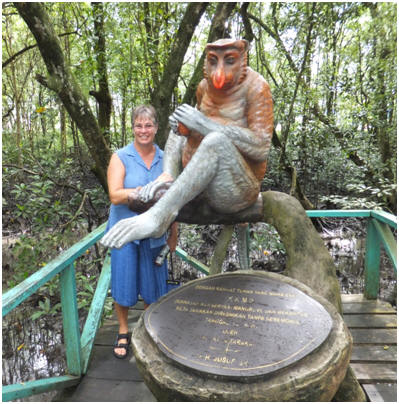
We joined the rally group the following day for a
tour of the highlights of Tarakan. First stop was the inner city Mangrove and
Proboscis Monkey reserve, which is an oasis for the monkeys, crabs, tree snakes
and ‘Ikan Temakul” a fish exclusive to the Kalimantan area that crawls over
mudflats on its fins.
We then did the WWII museum housed in a disused Australian Army bunker (see pic). It housed a small but interesting display of memorabilia, and historic photograph display of the development of Tarakan as an oil town
Whilst we were here the skies opened up and it poured with rain, it was decided a stop at a local Kopi (coffee) house was in order before we headed off to the next destination. We enjoyed some good hot coffee here and a variety of steamed buns.
The rain eased and we continued our travels to a replica traditional style village with representatives from the local tribe, along with a Sanpan boat moored in the manmade lake.
Following this visit the bus took us out
past the new mosque under construction to the WWII gun emplacements with a
pretty view out over the sea. Then this was followed with a few stops to pick up
supplies (beer and groceries) and more money for our on-going travels– you can
easily go through a million rupiah in a day ($150NZD), and most ATM's only issue
a maximum of 1.25million rupiah at a time.
That evening the Sail to Indonesia group were hosted by the Major of Tarakan to a meal, cultural show and song and dance evening. The food was good, speeches not too long and translated into both languages – it was a fun night out and not too late.
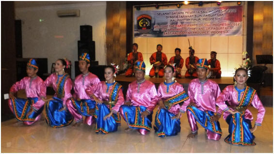
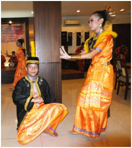
Our last day was spent picking up our fuel supplies, fresh fruit and vege, laundry, port clearance documents, and for Matt and I some time at an internet hotspot updating the website. Our final meal here was a renowned crab restaurant where we ate our fill of crab served in a variety of styles. We enjoyed our 4 day/5 night stop here in Tarakan, Indonesia . Although we don’t speak much Indonesian the locals have bent over backwards to help and accommodate us making us feel most welcome. They are intrigued and interested in our lifestyle – they have been incredibly hospitable. It has been great to have the rally organising team here sorting our documentation, fuel, water, laundry, shopping taking us on guided tours and out to the best local eateries, or sorting whatever our needs are. It takes so much hassle out. The last couple of weeks getting here have been rushed to make the deadline with the pressure on to keep moving along. It’s been nice to have been in one place for more than a couple of days, and the hotel stay was just what we needed – a holiday from the boat!!!

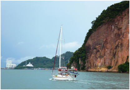
Sandakan (population 470,000 approx.) harbor is at
the end of another large river delta so the water is dirty and brown. We could
smell the pollution, and see the rubbish floating out from the harbor and river
delta for miles before we arrived! It seems the harbor is used as the local tip,
even though the city streets themselves were clean and tidy. If you ignored the
rubbish, our arrival up the river and into this port city was quite picturesque
as you sailed past a large rocky island that was formerly a leper colony/WWII
Prisoner of War Camp with the city emerging behind it as you went further into
the harbour. Matt said the rock “reminded him of Ayers Rock
in Australia.” Both the yacht Gypsy Rose and ourselves both had
issues with sucking up rubbish into our engine water intakes, which required
changing water pump impellers and a swim over the side – in the filthy water -
not pleasant!
On arrival we anchored outside the
Sandakan Yacht Club, as there are no marina facilities here. It is a local
drinking spot/club for this predominately Muslim area where alcohol is
forbidden. It has a nice little swimming pool, ablutions block, restaurant, and
is very cruiser friendly. For a small fee ($30 NZ for the year), we were granted
free use of the facilities along with a free club hat and polo shirt. The staff
were most helpful and attentive. This is also the only recommended secure
anchorage here in Sandakan, as it is right beside the marine police base. Never
the less, a yacht was robbed here last week! The waterways are
frantic with a variety of vessels from large ships, fishing vessels coming in at
all hours of the day and night along with local fishermen from the nearby
fishing villages and the nearby Philippines. It is renowned for being rife with
opportunist petty thieves (see above) who will stealthily climb aboard your boat
at night when you are sound asleep and take what they can find, especially
electronic goods. Thankfully the police and yacht club security staff keep an
eye out for you and your belongings. 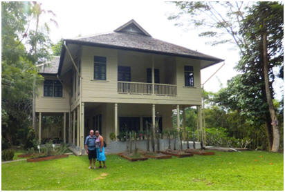
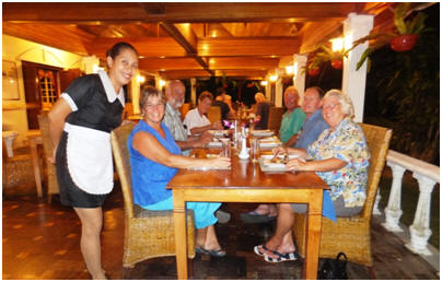
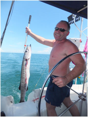

After leaving Sandakan we were soon back
in cleaner waters so decided to put out a fishing lines like all the local boats
around us. Around mid-morning we caught the first fish we have caught (on a
line) since leaving New Zealand 2 years ago! There was enough fish to offer to
feed the group of 4 yachts we are travelling with along this coast. (10 people)!
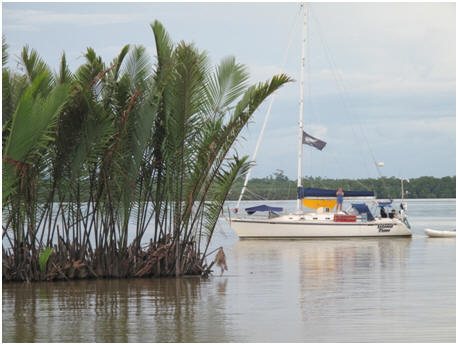 you
can apparently see Pygmy elephants, Rhinos, crocodiles, monitor lizards,
otters, many tropical birds and even orangutans and Proboscis Monkey’s that
come out of the jungle and along to the river around dawn and dusk. We anchored
in the swiftly moving river, and were about to launch our dingy and head to the
yacht Thumbs Up which was the designated “Party Boat” that night for the fish
BBQ, when down the river we observed a small floating island of palm fronds
coming down the river aiming directly at us! (see pic opposite) Thankfully it
missed all four yachts and happily continued its way out to sea. We did see a
number of these in the river, and out at sea along this coast.
you
can apparently see Pygmy elephants, Rhinos, crocodiles, monitor lizards,
otters, many tropical birds and even orangutans and Proboscis Monkey’s that
come out of the jungle and along to the river around dawn and dusk. We anchored
in the swiftly moving river, and were about to launch our dingy and head to the
yacht Thumbs Up which was the designated “Party Boat” that night for the fish
BBQ, when down the river we observed a small floating island of palm fronds
coming down the river aiming directly at us! (see pic opposite) Thankfully it
missed all four yachts and happily continued its way out to sea. We did see a
number of these in the river, and out at sea along this coast.
Our next stop was into a quiet little bay called “Dent Haven”, which hooks
into the
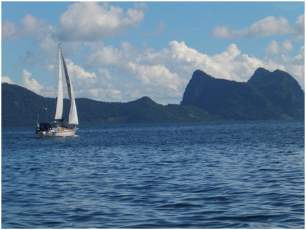 mainland.
We anchored under a cell phone tower and managed to get internet and catch up on
our mail. The following day we headed down to Gaya Island, which is part of the
Marine Reserve area around the world famous dive area of Semporna, and the
outlying island of Sipadan. Gaya is a pretty turquoise coloured reef with high
rocky bush clad hills coming right out of the sea in a horse shoe shape. We
enjoyed a cool night here with a good breeze flowing through the boat , making
sleeping much easier.
mainland.
We anchored under a cell phone tower and managed to get internet and catch up on
our mail. The following day we headed down to Gaya Island, which is part of the
Marine Reserve area around the world famous dive area of Semporna, and the
outlying island of Sipadan. Gaya is a pretty turquoise coloured reef with high
rocky bush clad hills coming right out of the sea in a horse shoe shape. We
enjoyed a cool night here with a good breeze flowing through the boat , making
sleeping much easier.

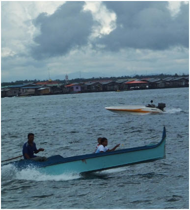
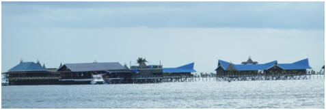
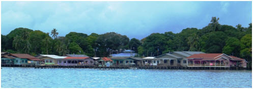
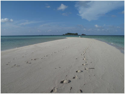
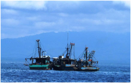

15-17 April 2012
The sailing in this region has been in flat calm
conditions with very little wind (under 5 knots) and so to cover the distances
we need to travel it has been mostly motorsailing. We have undertaken lots of
repair work and cleaning jobs while we have been going along in the cool of our
self made breeze and feel Island Time is Ship shape and organized for her return
down under.
Tawau is our last Malaysian port before we head
across the border to Tarakan, on the Indonesian side of Borneo (approx. 82
nautical miles away). The yacht club here (no marina again but an idyllic
sheltered anchoring spot), is the local drinking hole for the mainly Chinese
people in this town. The club is super organized, clean and tidy with a full
bar, internet, gym, sauna, steam room, pool, pool table and tennis courts, along
with a yummy cheap Chinese restaurant. The yacht club committee, management and
the youth training squad (racing optimists, lasers and 420's) were all
incredibly friendly, helpful and informative. We thoroughly enjoyed our very
brief stay here while we resupplied before crossing the border to Indonesia. The
town is also clean, tidy, well laid out and organized so easy to find your way
around and not too far to walk from the centrally located yacht club. Tawau is
recognized as the “Cocoa Capital of Asia”, and has a big Cocoa factory which I
was hoping to see but we didn’t get time to do (when I learned from the locals
that it only produces Cocoa Powder and not chocolate I wasn’t so disappointed!).
On our last night at the yacht club I was plied with several offers of drinks by
the locals at the bar so went to bed very relaxed and happy!!!

7-9 April 2012
Our 3 day and 2 night coastal passage to Sandakan was
a very easy motor sail in flat, calm conditions with very little wind, but just
enough to keep you cool. Having spent the last few weeks a bit marina/land bound
sailing up the East side of Malaysian Borneo where there are many large rivers
that are full of lots of tree debris and brown silted water from the
deforestation that stain and litter the sea with rubbish for quite a few miles
off the coast, so not very inviting to swim in. It was fabulous to
be back in clean, clear waters again weaving our way in and out of the numerous
little islands and coral reefs. I enjoyed some snorkelling and saw a beautiful
coral garden and tropical fish life at the anchorage stops. Matt spent one
afternoon re-plumbing one of our toilet breather lines – the vented loop on the
outflow pipe was leaking bad odours into the boat. It now breathes through a
through hull fitting, so that any odours released go outside!
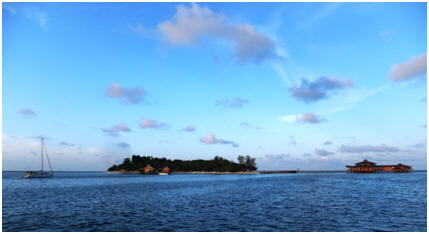

28th March -7th
April 2012
It was a 2 day coastal passage from Kota Kinabalu to
the top of Borneo and around to Kudat, with an overnight stop at the offshore
island of Mantanani. We hoped to get a nice island anchorage here after being
marina bound for the last couple of weeks. When we arrived at this island mid
afternoon we found it difficult to find a sheltered anchorage due the wind
conditions, sea state. The next location for a possible anchorage was back
inwards the main coast of Borneo several hours away. We eventually found a
location off the long coral reef at the end of the Island. It was a bit roly at
first in the afternoon breeze, but it did settle down overnight. We had a swim
and gave the bottom of the boat a bit of a wipe down of underwater growth after
it had sat in the marina at Kota Kinabalu for a couple of weeks. That evening we
enjoyed a very enjoyable BBQ meal in the fading light of a glorious sunset, and
then enjoyed an outdoor movie on our computer in the comfort and cool breeze in
the cockpit – a lovely way to end a day sail.
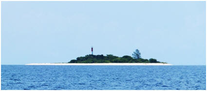 the
little town of Kudat. Kudat has a very secure and sheltered anchorage called the
“Duck Pond” that we have been told about by other yachties. That afternoon as we
sailed along the coast we sailed through several torrential afternoon heat
rainstorms that reduced visibility to 100metres at times. It did however fill up
our spare water cans on the deck from the improvised rain collection system Matt
made which is a good thing.
the
little town of Kudat. Kudat has a very secure and sheltered anchorage called the
“Duck Pond” that we have been told about by other yachties. That afternoon as we
sailed along the coast we sailed through several torrential afternoon heat
rainstorms that reduced visibility to 100metres at times. It did however fill up
our spare water cans on the deck from the improvised rain collection system Matt
made which is a good thing. By the time we needed to anchcor in the Duck Pond” at Kudat
the weather had cleared up.
food to get us through our sailing passage in the upcoming
months through Indonesia, Papua New Guinea and the Solomon’s where supplies will
be hard to source it would be very sad and expensive to lose/replace all this
food.
On the 5-6th April we had an enjoyable
overnight trip back to Kota Kinabalu for the Indonesian sailing rally meeting.
As you couldn’t hire a car directly in Kudat we hired a taxi mini van and driver
to get the group of 8 of us from 4 different yachts that are doing the rally and
are currently in Kudat to get us there. It was a 3 hour trip with the road
rather washed out in places as they try to repair damage from the last wet
season in time for the next! They don’t have precast concrete culverts etc to
use here so are having to use manual labour, using shutters and making up iron
reinforced bar frames before pouring in concrete to form them so the repair job
is a long slow process.
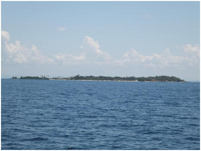 we must say). When we arrived at
the hotel we asked about location of meeting, having previously been informed of
a time to be there but not a meeting room location. The hotel staff knew nothing
about it! When we got hold of the organiser he informed us the meeting had been
postponed from 2.30pm till 5pm, and to gather at hotel restaurant. Matt headed
out to the marina office to pick up his new electronic chart update software
package that had been delivered there, and then enjoyed some air-con time in the
comfort of the hotel room updating his computer while I enjoyed the hotel pool
facilities. Late afternoon we dressed up for the meeting having been told that a
number of dignitaries/Minister of Tourism etc were going to be in attendance.
However in the end only the organiser and one minister came to the so called
technical/publicity briefing. The meeting itself was a very casual and short
update, question and answer session of the rally event before the minister and
organiser went off to another meeting with other local dignitaries for later in
the evening! Most of our meeting could have been covered by email without the
expense for many of us coming back to Kota Kinabalu or held at Tarakan where all
the yachties will be present prior to leaving mid April. On the plus side we
enjoyed the break from sweltering Kudat, the luxury of hotel accommodation along
with a fabulous buffet breakfast with a large and varied selection of foods from
Asia, Indian and western countries. We made the most of the decent free internet
coverage as well updating our computers and having skype catchups with various
family and friends. We also treated ourselves to another lovely meal at our
favourite Italian restaurant here in Kota Kinabalu. Before heading back to Kudat
we filled the mini van up fresh groceries ready for our next passage - to
Sandakan.
we must say). When we arrived at
the hotel we asked about location of meeting, having previously been informed of
a time to be there but not a meeting room location. The hotel staff knew nothing
about it! When we got hold of the organiser he informed us the meeting had been
postponed from 2.30pm till 5pm, and to gather at hotel restaurant. Matt headed
out to the marina office to pick up his new electronic chart update software
package that had been delivered there, and then enjoyed some air-con time in the
comfort of the hotel room updating his computer while I enjoyed the hotel pool
facilities. Late afternoon we dressed up for the meeting having been told that a
number of dignitaries/Minister of Tourism etc were going to be in attendance.
However in the end only the organiser and one minister came to the so called
technical/publicity briefing. The meeting itself was a very casual and short
update, question and answer session of the rally event before the minister and
organiser went off to another meeting with other local dignitaries for later in
the evening! Most of our meeting could have been covered by email without the
expense for many of us coming back to Kota Kinabalu or held at Tarakan where all
the yachties will be present prior to leaving mid April. On the plus side we
enjoyed the break from sweltering Kudat, the luxury of hotel accommodation along
with a fabulous buffet breakfast with a large and varied selection of foods from
Asia, Indian and western countries. We made the most of the decent free internet
coverage as well updating our computers and having skype catchups with various
family and friends. We also treated ourselves to another lovely meal at our
favourite Italian restaurant here in Kota Kinabalu. Before heading back to Kudat
we filled the mini van up fresh groceries ready for our next passage - to
Sandakan.

18-28th March 2012
Kota Kinabalu is our last major city and marina stop
before we head off to the more remote locations/countries that we will be
travelling through over the next 6 months or so. Our main priority here is to
ensure we have all the goodies and things we need before we leave for more
barren destinations. Kota Kinabalu, the capital of the Malaysian state of Sabah,
was prior to WWII known as Jesseltown. It was completely destroyed except for
one building during the Japanese occupation in WWII. As a result it is now quite
a modern city but is somewhat lacking in character with a haphazard and
uncoordinated design and layout from its rapid rebuild after WWII.
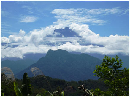 The
marina here is a high end resort, and country club facility. It has numerous
pools to chose from, a gym, sauna, cinema room, spa facility, badminton and
tennis courts, a bowling alley, numerous restaurants, karaoke, a variety of
speed boat water sports that you can do along with a top class golf course –in
fact whatever you want they can organise! That being said it is all pretty
pricey for our budget, and the food is not particularly startling for the money.
All the same we did enjoy the upmarket location and made good use of the pools
with the free unlimited free water supply, Island Time got a good cleanup while
we were here.
The
marina here is a high end resort, and country club facility. It has numerous
pools to chose from, a gym, sauna, cinema room, spa facility, badminton and
tennis courts, a bowling alley, numerous restaurants, karaoke, a variety of
speed boat water sports that you can do along with a top class golf course –in
fact whatever you want they can organise! That being said it is all pretty
pricey for our budget, and the food is not particularly startling for the money.
All the same we did enjoy the upmarket location and made good use of the pools
with the free unlimited free water supply, Island Time got a good cleanup while
we were here.
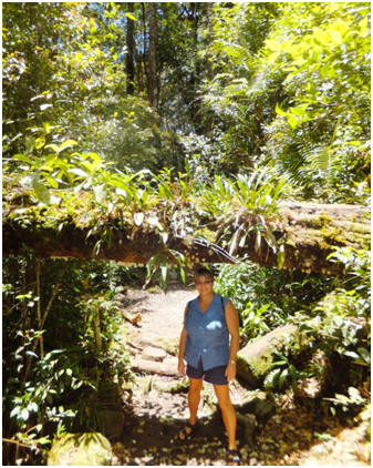 to
take us round town and show us the better shopping places, which was very
useful. They also offered to pay Matt for doing some work on their boat computer
system so this kept him busy for a few days and put of extra cash into our
pockets :-)
to
take us round town and show us the better shopping places, which was very
useful. They also offered to pay Matt for doing some work on their boat computer
system so this kept him busy for a few days and put of extra cash into our
pockets :-)
While here we took a day trip out to Mount Kinabalu
-the highest mountain in Malaysia. We did a circuit trip there and back managing
to catch glimpses of the Mountain in the morning as it peaked out of the clouds,
before it was totally shrouded in a layer of cloud by the afternoon. It was
dramatic but stark vista, but also seemed to be somewhat menacing in its
appearance.
At the National Park Headquarters we did a couple of
easy walks around the base of the mountain. Sadly in typical Malaysian style
with nothing ever maintained once it is completed and so the place was pretty
rundown, with neglected tracks, poor signposting, map layouts and with no
information centre. Really it quite disappointing as it has so much potential
with its designation as a world heritage site. However that being said the walk
we did was incredibly green and mossy with great biodiversity of plant life, and
enjoyed the cooler climate. The drive through the mountains took us through
interesting local habitats and market gardens terraced on the hillsides. We
purchased some fresh produce from the roadside stalls which was beautifully
presented and very tasty.
On our way back we eventually found the memorial
site and gardens at Kundasang. This was one end of the Sandakan Death Marches
during WWII.
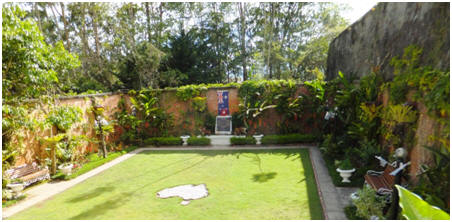 men
only 6 survived, due to the fact that they successfully escaped, and were hidden
by local Malay families until the final surrender of the Japanese. In recent
times it has been lovingly restored as a memorial site with 3 uniquely planted
and themed gardens to represent the British, Australian POW’s, and Malay
families that assisted the escapees. There was also a room with an interesting
documentary video giving an overview of what happened, along with detailed
information boards. It was a surprisingly emotional and stirring site to visit.
A very bad time for the mainly Ausy soldiers, being their worst military losses
ever. 99.7 percent. A real black mark in Japanese history.
men
only 6 survived, due to the fact that they successfully escaped, and were hidden
by local Malay families until the final surrender of the Japanese. In recent
times it has been lovingly restored as a memorial site with 3 uniquely planted
and themed gardens to represent the British, Australian POW’s, and Malay
families that assisted the escapees. There was also a room with an interesting
documentary video giving an overview of what happened, along with detailed
information boards. It was a surprisingly emotional and stirring site to visit.
A very bad time for the mainly Ausy soldiers, being their worst military losses
ever. 99.7 percent. A real black mark in Japanese history.
Our return trip back we drove over a windy and at
times narrow, poorly maintained road with patches of low cloud and rain that at
one stage that made driving very treacherous. Finally on our safe arrival back
in Kota Kinabalu we found a fabulously delicious Italian restaurant for a meal
that was a real treat - with the best fresh bread we have tasted in a long, long
time. This has become our favourite eating place in Kota Kinabalu. (Its called
Little Italy)
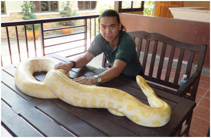 It
looked quite impressive on the outside with a flash entrance ticketing, carpark,
shop/gift area. However once inside we found many of the main animal enclosures
could have done with upgrading and given larger spaces for the captive animals
to roam in. Perhaps the whole place is slowly being upgraded from the entrance
first, but it would have been good to see the animal areas done before the
people places in our view. That being said the staff were very friendly and
seemed to be genuinely interested in the animals. The wildlife/bird show was
quite entertaining and well put together. I got selected to participate in the
show with the Macaw parrots which I’m sure my parrot mad daughter Sue at home in
NZ would have been pleased to see.
It
looked quite impressive on the outside with a flash entrance ticketing, carpark,
shop/gift area. However once inside we found many of the main animal enclosures
could have done with upgrading and given larger spaces for the captive animals
to roam in. Perhaps the whole place is slowly being upgraded from the entrance
first, but it would have been good to see the animal areas done before the
people places in our view. That being said the staff were very friendly and
seemed to be genuinely interested in the animals. The wildlife/bird show was
quite entertaining and well put together. I got selected to participate in the
show with the Macaw parrots which I’m sure my parrot mad daughter Sue at home in
NZ would have been pleased to see.
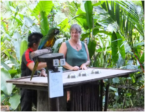

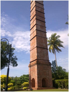
15-18th
March 2012
After the uncomfortable conditions of the previous
day, it was a pleasant ½ day up to the Island of Labuan (just off the coast of
Brunei). This is another Malaysian duty free Island that we wanted to make the
most of for replenishing our alcohol supplies. Being a largely Muslim region
getting alcohol is generally not easy to source and usually very expensive, so
worthwhile stocking up when you can. We had to anchor in the busy port area as
the marina here is closed and under repair. There is lots of traffic as the port
is used as a service port and shipyard for the large oil well industry in this
area. Also there are numerous ferries coming in from Brunei and Malaysia to
obtain duty free supplies, cruise ships and many small local fishing vessels
from nearby fishing village (where they have their houses built on silts over
the water).
We did hire a car from a local for the day to enable
us to tour around the islands highlights (there are no hire cars on this small
island only taxis). Our only request was that it have airconditioning however
when it arrived it turned out to be a bit of a wreck, and although it did have
airconditioning like we had specifically asked one of the windows wouldn’t
windup, so it wasn’t terribly effective. Also the suspension was broken making
for a rather uncomfortable ride with 4 of us in it. However there weren’t many
options so we made the most of having it.
settlement below. Whatever the attached museum was a cool respite from the heat providing interesting information, history and relics of the coal mining era along with details of its recent restoration process and unusual construction method.
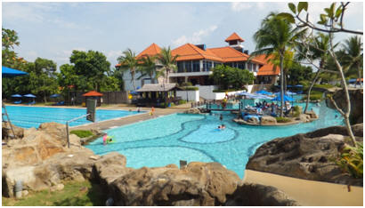 ve
the hull of the boat a clean, I also had a snorkel around the bay. Quite a good
breeze came up during the night, which made it cool for sleeping, but Matt was
anxious about blowing onshore, so had a restless night. From here it was another
day sail onto Kota Kinabalu, with a few hours of real sailing (no motor
assistance for a change). We stopped for an afternoon swim at the small island
group/marine reserve just outside of the main town of Kota Kinabalu before
heading into the marina. Sadly the coral here has been destroyed in the past by
the practice of dynamite fishing, and is only just beginning to make a comeback.
There is very little fish life here, so I hope that this pretty marine
environment will recover over time from the damage now that it is a reserve.
However it was very pleasant to cool off in the heat of the day before tying up
at the marina.
ve
the hull of the boat a clean, I also had a snorkel around the bay. Quite a good
breeze came up during the night, which made it cool for sleeping, but Matt was
anxious about blowing onshore, so had a restless night. From here it was another
day sail onto Kota Kinabalu, with a few hours of real sailing (no motor
assistance for a change). We stopped for an afternoon swim at the small island
group/marine reserve just outside of the main town of Kota Kinabalu before
heading into the marina. Sadly the coral here has been destroyed in the past by
the practice of dynamite fishing, and is only just beginning to make a comeback.
There is very little fish life here, so I hope that this pretty marine
environment will recover over time from the damage now that it is a reserve.
However it was very pleasant to cool off in the heat of the day before tying up
at the marina.
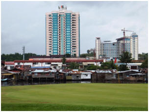

26th Feb-13th March 2012
Miri is an oil industry service town with a mix of ex-pats and locals, and large range of buildings -from simple shacks, to high rises and very salubrious homes. The marina here is secure and one of the few in Malaysia we have come across that is properly constructed. Unfortunately it seems the money for the marina development ran out before proper office and ablution blocks could be completed. The toilets and showers are in a container shed and the office is a 5 min drive away in another block of shops. There are a number of yachties here who have been here for some time - they are very friendly, knowledgeable and helpful about the area. After securing our marina berth it was a relaxed afternoon to recover from our overnight passage and drama of hitting something in the dark of night.
We organised a hire car the next day with Thumbs Up and headed into town to get our bearings, some money and a meal at a friendly outdoor cafe called Ming. (Ming was recommended in lonely Planet). The next day I did a bit of on-line research and bookings to get us organised for a trip to the World Heritage National Park of Gunning Mulu, which has been highly recommended to us. It requires flying in and out and there is very limited accommodation available at the park so you have to book ahead.
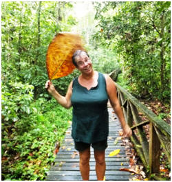
On the 29th Feb we had a day’s outing into the Niah National Park and caves approximately 100kms out of Miri. This cave area is of particular interest to archaeologists, who in 1958 discovered evidence of human occupation dating back some 40,000 years. It is dubbed as the cradle of human civilisation in the region. The vegetation is dense with the call and sounds of the wildlife surrounding you and following your progress as you transverse the raised boardwalk.
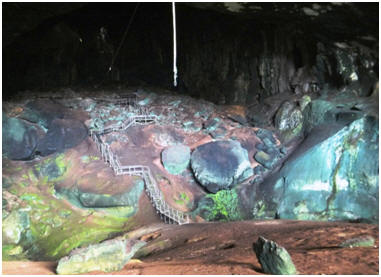 collectors
used to carry out their transactions. This is followed by the Great Cave which
is 250 metres wide at the entrance and up to 60 metres high. The track meanders
through the cave and past various rock formations and overhead vents where the
sunlight penetrates the cave gloom. Bamboo platform constructions reach up to
the ceiling that the locals use to collect Swiftlet bird nests for the Chinese
delicacy ‘Birds Nest Soup’. Matt and I also headed down a rickety and very
dilapidated board walk a further 1.4 kms to the painted cave, which was is a
burial site with some rock drawings, and remnants of tribal boat coffins, which
were used to send the spirits off in.
collectors
used to carry out their transactions. This is followed by the Great Cave which
is 250 metres wide at the entrance and up to 60 metres high. The track meanders
through the cave and past various rock formations and overhead vents where the
sunlight penetrates the cave gloom. Bamboo platform constructions reach up to
the ceiling that the locals use to collect Swiftlet bird nests for the Chinese
delicacy ‘Birds Nest Soup’. Matt and I also headed down a rickety and very
dilapidated board walk a further 1.4 kms to the painted cave, which was is a
burial site with some rock drawings, and remnants of tribal boat coffins, which
were used to send the spirits off in.
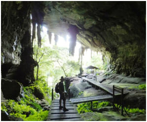 helped
clean us up from the bat and bird shit, and helped to freshen us up a bit.
helped
clean us up from the bat and bird shit, and helped to freshen us up a bit.
Another couple of boat job days along with outings to locate various bits and pieces. We also paid a visit to the Petroleum Museum up on Canada Hill behind the town. The best part about it was the views over the countryside and coastline. The museum itself although only 7 years old and quite a grandly styled architectural structure was in true Malaysian style badly dilapidated with no upkeep. Many of the interactive exhibits did not work, and there were rain puddles on the floor- it was disappointing.
The 4th March we headed out for another
exploration of a local National Park –Lambir Hills. We did the waterfall track
which was short and
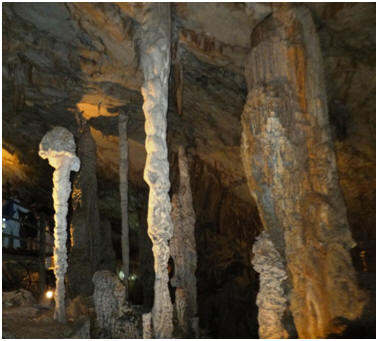 pretty but
water conditions not particularly inviting for a swim. So we then decided to do
the loop track back to the headquarters. After a climb up a path of 120 steps to
the sign posted canopy tower we discovered it had been closed and partially
dismantled as it was no longer safe. We completed the remaining loop track in
just under 3 hours. However it was quite a walk clambering up and down
hillsides, with the shallow tree roots acting as steps. The humidity was very
high on this day and we certainly had quite a workout on this trail getting our
heart rates up and the sweat pouring out of us. We slept well that night!
pretty but
water conditions not particularly inviting for a swim. So we then decided to do
the loop track back to the headquarters. After a climb up a path of 120 steps to
the sign posted canopy tower we discovered it had been closed and partially
dismantled as it was no longer safe. We completed the remaining loop track in
just under 3 hours. However it was quite a walk clambering up and down
hillsides, with the shallow tree roots acting as steps. The humidity was very
high on this day and we certainly had quite a workout on this trail getting our
heart rates up and the sweat pouring out of us. We slept well that night!
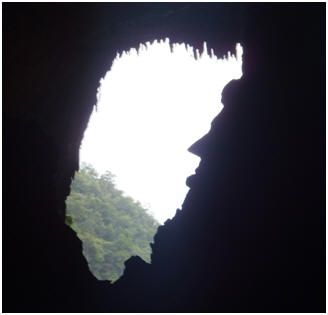
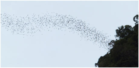 entrance
in a number of wave formations. We also completed a tree canopy walk which gives
you quite a different outlook and perspective. While doing this we got to see
several young tree lizards and witnessed their amazing colour transformation, to
suit the environment (green amongst the leaves, brown on the planks). We
unfortunately missed out of doing a night walk which is the time when the
wildlife comes alive, due to torrential rain. The park information centre was
very well done and inform
entrance
in a number of wave formations. We also completed a tree canopy walk which gives
you quite a different outlook and perspective. While doing this we got to see
several young tree lizards and witnessed their amazing colour transformation, to
suit the environment (green amongst the leaves, brown on the planks). We
unfortunately missed out of doing a night walk which is the time when the
wildlife comes alive, due to torrential rain. The park information centre was
very well done and inform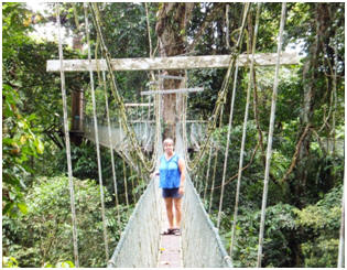 ative
with several good video’s to watch.
ative
with several good video’s to watch.
We enjoyed our time in Gunung Mulu National Park. The park is managed by an Australian couple and is extremely well run, organised and maintained. It certainly stands out as an example to other Malaysian parks on how to do the job properly.
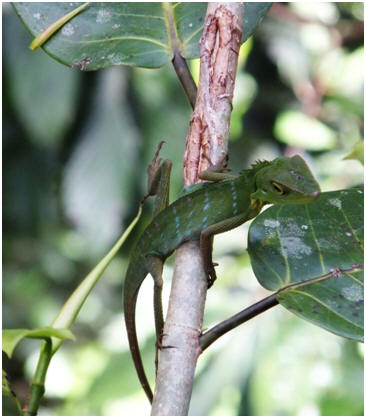
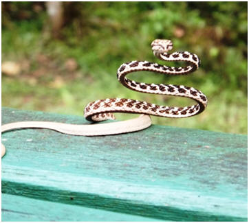
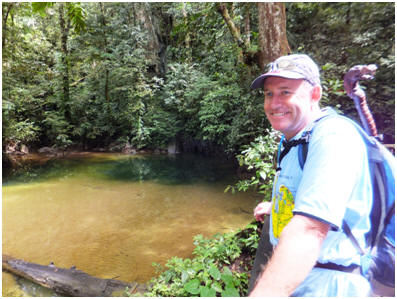
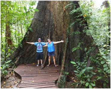
Following our return from the National Park we were just waiting for a suitable weather window to head up the coast further. We have decided to give Brunei a miss (we have already seen the highlights of here during our stopover back to NZ December 2010 anyway). Also it would avoid doing another customs and immigration procedures, and we have been advised that the opportunity to buy cheap fuel in Brunei has now become a very difficult process for non-nationals, making it not worth the effort. We finally got away on the 13th March, planning to do an overnight sail to the duty free Island of Labuan off the coast of Brunei.

21-26th February
2012
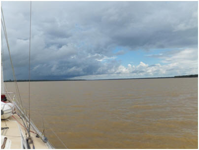 After a
delayed start in getting away from Kuching, as Ivan from the yacht Thumbs Up
couldn’t start his motor that morning – a dead solenoid. Fortunately Matt had a
spare one and did a repair job for them, but it meant we arrived at the Rajang
River mouth (in the dark) following a full day trip up the coast from Kuching.
After a
delayed start in getting away from Kuching, as Ivan from the yacht Thumbs Up
couldn’t start his motor that morning – a dead solenoid. Fortunately Matt had a
spare one and did a repair job for them, but it meant we arrived at the Rajang
River mouth (in the dark) following a full day trip up the coast from Kuching.
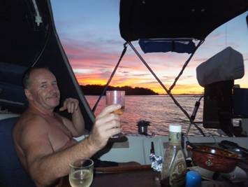 Not
the best of scenario’s entering an unfamiliar river bar at dark, but with our
forward sounding sonar we are able to accurately read the contours and depth of
the sea/river bed along with radar to see the coastline and other boat traffic
we were able to safely make the entrance.
Not
the best of scenario’s entering an unfamiliar river bar at dark, but with our
forward sounding sonar we are able to accurately read the contours and depth of
the sea/river bed along with radar to see the coastline and other boat traffic
we were able to safely make the entrance.
On waking the next morning it
was wet with poor visibility so we decided to delay further travel and have a
lazy day. However Matt ended up doing yet another toilet repair job when the
seal of our rear toilet failed! We did have a lovely BBQ meal that evening with
a lovely sunset over the river mouth, and saw fireflies flitting around the boat
in the night light. This was quite exciting as I’ve never seen then
before. The next day following a pleasant relaxed special breakfast to start our
27th Wedding Anniversary day (23rd Feb), we headed further
up the river system. We passed tribal longhouses, a variety of river traffic and
dodged lots of logs. Our navigation computer died 20 mins after starting the
trip, so I had to drive and navigate while Matt worked on the computer to get it
running again. When we got to the anchor point we had the added bonus of
internet reception to pick up anniversary messages. It is amazing that even in
these remote river passages we have cell phone internet coverage! Had planned
to have an el fresco cockpit meal and drink of wine to celebrate our day, but
the mozzies were so fierce we
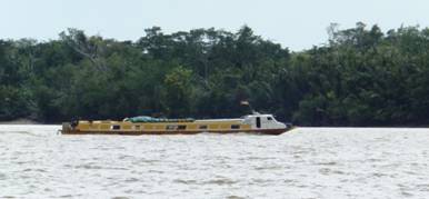 had
to hide below instead!
had
to hide below instead!
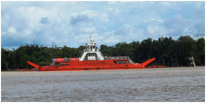 The
locals standing fishing in the water so can’t be too much of a problem.
The
locals standing fishing in the water so can’t be too much of a problem.
Unfortunately our navigation computer packed up again this
morning shortly after starting, Matt was quickly able to get one of our others
connected, and once we were anchored just inside the river mouth exit he spent
more time investigating the problem. It turned out that the cooling fan was
overheating after a short time and stopping/slowing the computers processing.
This has now been cleaned out and hopefully will continue to work properly now
without stopping. Following that he cleaned out the inlet hoses on the
front toilet, which had some sort of our blockage (smelt like a dead fish!). It
seems our toilet issues are never ending, and not one of Matt’s favourite jobs!
It has been an interesting change
taking Island Time up a river system, and certainly a change from doing sea
coastal passages. The currents running up and down the river with the tides are
quite something – up to 5 knots we have had at times. We have had to clear away
river debri/logs that have piled up against our anchor chain. Back out to sea
again tomorrow for an overnight passage up to Miri, the next main port.

10-13th Feb 2012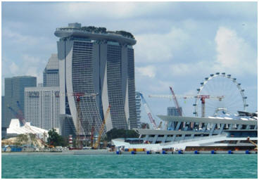
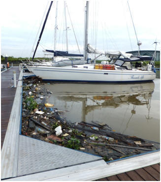
We arrived at Kuching around midday on the 13th, after making our way about 14 km’s up the river to the town and marina area. The river made for an interesting trip with numerous ships ploughing the waterway, industry and power stations along the riverbanks. As it is the monsoon season here at present the water is littered with logs and rubbish that is being washed out to sea. The marina which is located on the edge of town is subject to the tidal current and river flow. During spring tides the current can run at a speed of up to 6 knots (12 Km’s), rubbish that is flowing down the river piles up around your boat, including whole palm trees with root and all as you can see in this picture on the right.
13-20th February
 The
next day after an enjoyable sleep following our passage we arranged to hire a
car through the marina manager here. Unfortunately it broke down at the service
station after we filled it up with fuel– a flat battery and alternator that
wouldn’t charge it. We had to then wait for another car from the hire
company!.Anyway the service station attendants were very helpful and presented
my friend (Cheryl from Thumbs Up another yacht that we are travelling with and
sharing car hire with), and I with fancy heart shaped Valentines days balloons
and took photos of us “old ladies” with them on their cellphones. White tourist
faces are a bit of a novelty here!
The
next day after an enjoyable sleep following our passage we arranged to hire a
car through the marina manager here. Unfortunately it broke down at the service
station after we filled it up with fuel– a flat battery and alternator that
wouldn’t charge it. We had to then wait for another car from the hire
company!.Anyway the service station attendants were very helpful and presented
my friend (Cheryl from Thumbs Up another yacht that we are travelling with and
sharing car hire with), and I with fancy heart shaped Valentines days balloons
and took photos of us “old ladies” with them on their cellphones. White tourist
faces are a bit of a novelty here!
Once we had another car sorted we headed into the
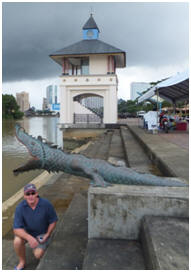 centre
of town and got some information from the visitor centre and had a bit of a walk
around the riverfront. Then we headed out to the new mall here for dinner and
some groceries. They had this cool Valentine ’s Day idea organised by a
non-profit group to raise money for heart surgery for locals who can't afford
it. They were selling heart cookies and cakes, t/shirts and doing romantic look
photos for a small charge. I thought this was a great cause and idea for
Valentine’s day and indulged in some of the baking which was delicious I must
say.
centre
of town and got some information from the visitor centre and had a bit of a walk
around the riverfront. Then we headed out to the new mall here for dinner and
some groceries. They had this cool Valentine ’s Day idea organised by a
non-profit group to raise money for heart surgery for locals who can't afford
it. They were selling heart cookies and cakes, t/shirts and doing romantic look
photos for a small charge. I thought this was a great cause and idea for
Valentine’s day and indulged in some of the baking which was delicious I must
say.
The next morning
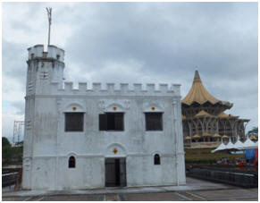 we
headed back into town and did the the historic inner city/waterfront walking
tour outlined in the Lonely Planet guide. We also went to a very interesting
Chinese museum about their integration and populating of this area. Approx ¼ of
the population here in Kuching are Chinese.
we
headed back into town and did the the historic inner city/waterfront walking
tour outlined in the Lonely Planet guide. We also went to a very interesting
Chinese museum about their integration and populating of this area. Approx ¼ of
the population here in Kuching are Chinese.
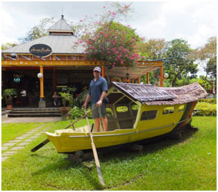 Following this we found a lovely little riverside restaurant to enjoy
lunch. We planned to do a river tour mid-afternoon but it started
Following this we found a lovely little riverside restaurant to enjoy
lunch. We planned to do a river tour mid-afternoon but it started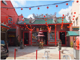 to rain so
decided to postpone that till the next day and
headed to the main museum instead. This was a good place to spend a couple of
hours while it absolutely poured down with monsoonal rains. It was still raining
very hard at 5pm so we decided to head back out to the new shopping mall to see
the Star Wars movie (Phantom Menace) that has been re-digitised in 3D
to rain so
decided to postpone that till the next day and
headed to the main museum instead. This was a good place to spend a couple of
hours while it absolutely poured down with monsoonal rains. It was still raining
very hard at 5pm so we decided to head back out to the new shopping mall to see
the Star Wars movie (Phantom Menace) that has been re-digitised in 3D
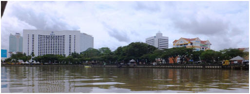
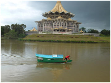
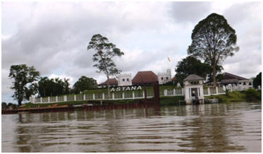
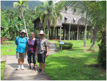 today in
Borneo. Each house had members of the “tribe” available to talk you about their
way of life, type of house and demonstrations of their art forms and culinary
delights which you could buy bags to sample. They also had spear and blow pipe
making, spinning top making and games that you could try, as well as local
indigenous instruments. At the end there was a 45min cultural show in a lovely
air-conditioned theatre which was a nice way to end the afternoon. They
explained the dances and each one was nice and short and interesting dance
interpretation of cultural event such as wedding/funeral/harvesting.
today in
Borneo. Each house had members of the “tribe” available to talk you about their
way of life, type of house and demonstrations of their art forms and culinary
delights which you could buy bags to sample. They also had spear and blow pipe
making, spinning top making and games that you could try, as well as local
indigenous instruments. At the end there was a 45min cultural show in a lovely
air-conditioned theatre which was a nice way to end the afternoon. They
explained the dances and each one was nice and short and interesting dance
interpretation of cultural event such as wedding/funeral/harvesting.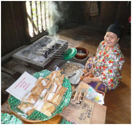
We returned to town and had a very enjoyable Lebanese meal at a waterfront
restaurant which was a nice change in diet options and it was pretty to see the
waterfront at night which is lit up with highlight lightening adding to the
atmosphere and making the old castle and walkway look very striking.
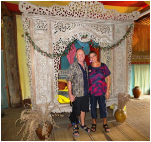
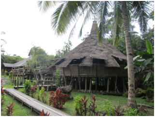
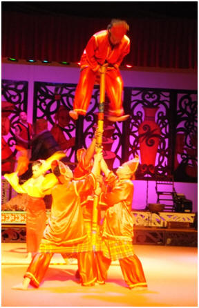
17th Feb - Ivan (from the yacht Thumbs Up), and Matt want a boat maintenance day
today and so Cheryl and I enjoyed a girls shopping day.
18th Feb – Today we
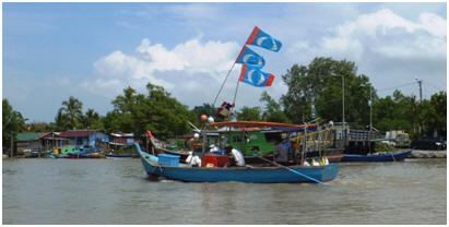 peninsula
that overlooks the South China Sea only ½ hours drive from Kuching. It has a
great bio-diversity and a range of trails. You take a 20 minute
small boat ride out to the park, from the nearby local fishing village passing a
variety of fishing boats and net systems.
peninsula
that overlooks the South China Sea only ½ hours drive from Kuching. It has a
great bio-diversity and a range of trails. You take a 20 minute
small boat ride out to the park, from the nearby local fishing village passing a
variety of fishing boats and net systems.
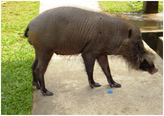 there
was a very friendly (and overfed by the tourists), bearded pig that was cruising
around the grounds. From here we made our way along the mangrove
there
was a very friendly (and overfed by the tourists), bearded pig that was cruising
around the grounds. From here we made our way along the mangrove
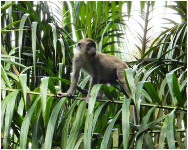 boardwalk out
to the start of our trail out along the peninsula. The “walk” was very
interesting with a great variety of flora and fauna to observe including bull
ants, swallow and bat caves, long-tailed macaques monkey’s, the rare proboscis
monkey, brightly coloured dragonflies and mud crabs.
boardwalk out
to the start of our trail out along the peninsula. The “walk” was very
interesting with a great variety of flora and fauna to observe including bull
ants, swallow and bat caves, long-tailed macaques monkey’s, the rare proboscis
monkey, brightly coloured dragonflies and mud crabs.
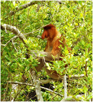 back
to the Headquarters rather than walk back out. Matt and I however walked back
completing the trail in 35mins, but we certainly got a good sweat up! We
returned back to our yachts just as the late afternoon monsoon torrential
downpour started. I had a rain water shower on the back deck and washed my
clothes at the same time it was so heavy!
back
to the Headquarters rather than walk back out. Matt and I however walked back
completing the trail in 35mins, but we certainly got a good sweat up! We
returned back to our yachts just as the late afternoon monsoon torrential
downpour started. I had a rain water shower on the back deck and washed my
clothes at the same time it was so heavy!
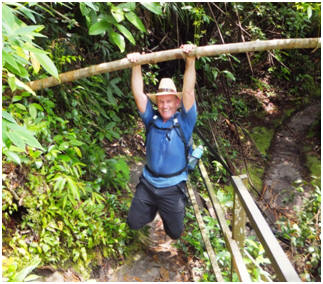
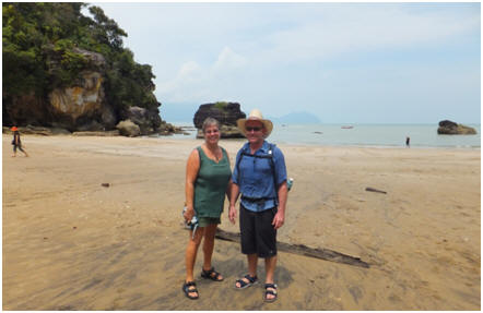
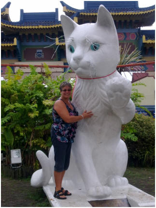 We
want to ensure both boats are fully checked over and well prepared for the trip
“Downunder”, as once we leave Malaysia we will be travelling in some very remote
and isolated places where getting jobs done and sourcing parts will be very
difficult or impossible. There will be no more supermarkets for around 4
months!!! so our boats need to be filled with the necessary food supplies to
last during this time.
We
want to ensure both boats are fully checked over and well prepared for the trip
“Downunder”, as once we leave Malaysia we will be travelling in some very remote
and isolated places where getting jobs done and sourcing parts will be very
difficult or impossible. There will be no more supermarkets for around 4
months!!! so our boats need to be filled with the necessary food supplies to
last during this time.
Kuching means “Cat” in Malay and so there were lots of kitsch style monuments around town at various locations including a Cat Museum that is devoted to all things feline!
Kuching is a historic river town with an interesting mix of old and new. This Malaysian state of Sarawak was originally under the control of the Sultan of Brunei. Following a period of history involving considerable tribal infighting the arrival of James Brooke in 1839 , in his well armed yacht ‘The Royalist’ the Sultan of Brunei asked for his assistance to settle the rebellious tribes. The spears and muskets of the local tribes were no match against James Brooke’s well armed ship and the conflicts soon ended. As a reward for ‘bringing about the peace’, the Sultan of Brunei awarded James Brooke the status of “White Raja” of Sarawak in 1841. For generations, in fact until the invasion of the Japanese in WWII, this family strongly influenced this area, building and setting up Parliamentary and Court systems, a ship yard along with grand castles to live in.
We have really enjoyed our weeks stay here. The central city riverside development is aesthetically pleasing with pretty gardens and informative historic plaques, and diverse old and new buildings - it is very pleasant to meander along. There are a range of activities to do, with good museums and shopping to keep you busy when the torrential rains hit. We have enjoyed a variety of eateries here and supported local tourism by purchasing some handcrafts. The people have been very friendly and obliging, as white-faced tourists not overly common here yet so the locals are genuinely interested in you and where you have come from. It has been a fun and educational experience.

31st January -10th February 2012
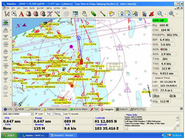
After negotiating the busy shipping lanes surrounding the waters of Singapore (see insert navigation screen pic of a section of the Singapore waterways showing all the ship identification symbols), we arrived safely at the One°15 Marina at Sentosa Island that we had heard rave reports about from other yachties. We completed the necessary arrival and clearance documentation and then headed to the nearby infinity pool for a swim.
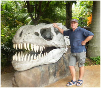
Matt and I had a day at Universal Studio’s to indulge me in my Theme Park thrills. We spent the whole day doing the rides and waiting in the queues. I must say the Los Angeles and Gold Coast Australia Universal Studios parks have much more on offer, but I enjoyed my day out.
We also took a trip to the Night Safari Zoo staying till the close at mid-night. It was interesting to see the nocturnal animals out in their environments at their awake and active time. We saw animals we have never seen before including many varieties of Cerval Cats, Sloth Bears, Pygmy Elephants, Bongo Antelope, Rhinoceros, Slow Lorus. We also paid a visit to the local maritime museum here which was interesting to view as it covered many of the ports we have visited in our travels
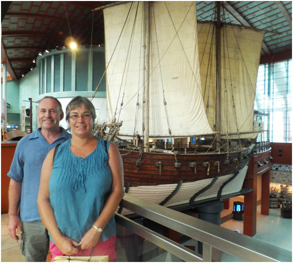

29-30th January 2012
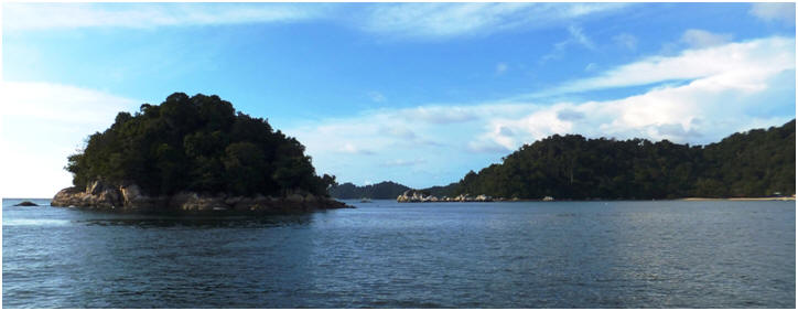 We
had a couple of easy day trips with overnight stops at these islands groups.
Both are very picturesque and tranquil little islands and were pleasant
anchorages to break up the passage before the business of Singapore and the
shipping lanes there. There were lots of fishing traps in these waters (little
wooden stake structures with a shelter hut or platform on top – see pic), so you
had to keep a watchful eye out for these that are scattered down the coastline
and are quite difficult to spot until up close. Also there is a myriad of local
fishermen out in their little boats with nets and floats strung out for quite a
distance. This is one of the reasons you don’t want to sail through these waters
at night, as the boats are small and unlit and a real danger to your boat to get
caught up in their nets.
We
had a couple of easy day trips with overnight stops at these islands groups.
Both are very picturesque and tranquil little islands and were pleasant
anchorages to break up the passage before the business of Singapore and the
shipping lanes there. There were lots of fishing traps in these waters (little
wooden stake structures with a shelter hut or platform on top – see pic), so you
had to keep a watchful eye out for these that are scattered down the coastline
and are quite difficult to spot until up close. Also there is a myriad of local
fishermen out in their little boats with nets and floats strung out for quite a
distance. This is one of the reasons you don’t want to sail through these waters
at night, as the boats are small and unlit and a real danger to your boat to get
caught up in their nets.
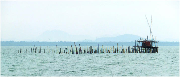

23-28th January 2012
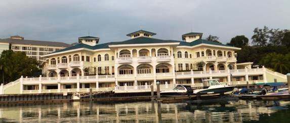 It’s
a very nice facility here, as you can see by the pictures. The marina here has a
properly built seawall and new docks so is very secure. The staff are all
friendly, and the pool is very inviting, shady and cool. An added bonus on
our arrival here was to catch up with the crew from the yacht Whisper HR that we
had spent some time with during the Sail Indonesia rally in 2010. During 2011
they did the East Malaysia rally, which is where we are heading next and so we
were able to pick their brains for information on the best things to see and do.
It’s
a very nice facility here, as you can see by the pictures. The marina here has a
properly built seawall and new docks so is very secure. The staff are all
friendly, and the pool is very inviting, shady and cool. An added bonus on
our arrival here was to catch up with the crew from the yacht Whisper HR that we
had spent some time with during the Sail Indonesia rally in 2010. During 2011
they did the East Malaysia rally, which is where we are heading next and so we
were able to pick their brains for information on the best things to see and do.
Matt has spent time as usual doing boat maintenance
including some dingy repair work using some new glue we purchased in Langkawi.
Unfortunately there was a particularly potent chemical in one of the solvents
that he was using to get rid of the old glue which burnt patches on his skin on
his hand, back and thigh. Some of these blistered and so he has been a bit
tender and sore on these spots for a few days, but is improving now. He also
altered our wet weather cockpit screens so hopefully they won’t drip onto our
seating anymore. Waiting for a thunderstorm to test them in now.
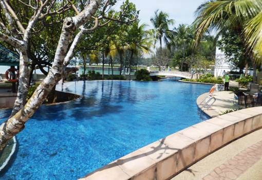

26th January 2012
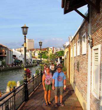 We shared a hire
car with Ivan and Cheryl from Thumbs Up for a change of scene and Cheryl was
keen to revisit the town before we left this area of Malaysia. It was also a
good distraction for Matt as his hand and back have blistered from the burns and
so he is a bit tender and sore – he is feeling better today though.
We shared a hire
car with Ivan and Cheryl from Thumbs Up for a change of scene and Cheryl was
keen to revisit the town before we left this area of Malaysia. It was also a
good distraction for Matt as his hand and back have blistered from the burns and
so he is a bit tender and sore – he is feeling better today though.
We had a pleasant drive on the side roads from Port
Dickson where we are (you get to see more of the real way of life for Malaysians
than driving on the toll road) – though I must say the road was a bit beaten up
and the hire car we had was a bit dilapidated with little suspension in the back
with the four of us in the small car so we felt the bumps very harshly. Anyway
it was supposed to be a 45min trip but we got a bit lost so ended up with a
scenic detour through some local seaside villages/resort areas. Once we got to
the centre of Melaka it was traffic gridlock due to the Chinese New Year
celebration holidays here, and Melaka is a popular tourist destination. Anyway
we eventually got a park and headed out find a place for some food. We walked
along the pathway of the waterway where they have now painted the backs of all
the buildings with interesting and bright murals which look great.
However as many Chinese people often take an
extended 2 week holiday break during this New Year period – although the
official public holiday is only 4 days many of the shops were closed as they are
Chinese owned and operated L. We eventually ended up at nice restaurant called
“1673” – the oldest in Jonker Street, for what turned out to be a very late
lunch (3pm). After that we wandered down Jonker Street some more –but it
was hot packed and crowded. I did find a new top to buy however to buyJ Then
found a chocolate shop where we indulged in some free tasting, and of course
some delectable purchases! There was lots of interesting signage on the walls
about the health benefits of chocolate to make you feel OK about your
indulgences!
After that we found a building that was originally
built in the 1600’s which had been abandoned during 1990-2005, but has been
recently restored. When it was abandoned the local Swiftlet (like swallows)
birds started to make it their home building nests in the rafters etc. Swiftlet
bird nests are a popular and expensive Asian delicacy, and so therefore this
house was restored without turning the birds away from their new abode. Instead
it has been turned into a operational manufacturing and visitor information
centre about the processing of the nests for the market place.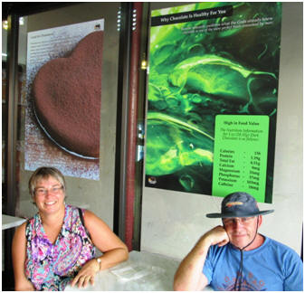
We have seen many commercially designed birds nest
buildings in Asia but you are not normally allowed inside to disturb the birds
as it is such a lucrative business. So it was very interesting to go through
this restored house and see the birds in action in this habitat that has been
carefully restored around the birds environment. In the wild they live in caves,
which are very inaccessible to get to.
It was also interesting to see the very labour
intensive manufacturing process to clean the birds’ nests of feathers and dirt,
and then remould the remaining birds nest tissue into shape, dry it and package
it for the market. We did not try any of the soup having had our fill of late
lunch and chocolates and it is a very expensive dish. We then drove back to Port
Dickson along the toll road so we wouldn’t get lost in the dark. I hadn’t taken
my phone with the navigation maps which had been a mistake!
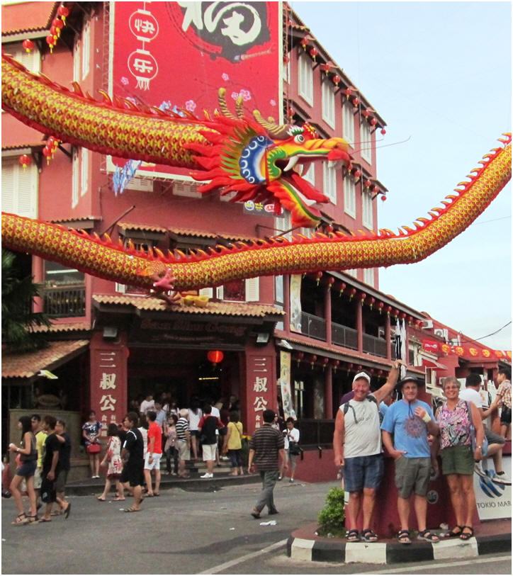

22nd January 2012
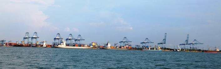 .
.
 We
used all the daylight hours we had today to make the long passage of 81 nautical
miles from Pangkor down the coast of Malaysia towards Port Klang. The conditions
were overcast with a few light showers to cool down the temperature, which made
our travels quite comfortable. In the afternoon as we drew closer to the narrow
coastal waterways around Port Klang we were sucked in by the tide which assisted
our speed by up to two knots. Therefore we were able to anchor further down the
coast than originally planned, which would make our passage the next day
considerably shorter.
We
used all the daylight hours we had today to make the long passage of 81 nautical
miles from Pangkor down the coast of Malaysia towards Port Klang. The conditions
were overcast with a few light showers to cool down the temperature, which made
our travels quite comfortable. In the afternoon as we drew closer to the narrow
coastal waterways around Port Klang we were sucked in by the tide which assisted
our speed by up to two knots. Therefore we were able to anchor further down the
coast than originally planned, which would make our passage the next day
considerably shorter.
We anchored in the mud near the mangroves opposite
the main cruise ship terminal of the port area. This is the major port for the
region and has around 10 miles of fwharfs and cranes, so is very busy. It is
interesting passing through this area and watching the variety of shipping and
tugs in action.

19-21st January 2012
We ended up spending an extra night in Penang that
we didn’t plan for, as Matt helped sort out a few issues out on
 the
yacht Thumbs Up (they kindly paid for an extra night in the marina as a result.)
We then headed down the coast of Penang Island and anchored at the far end ready
for an early get away for the long leg down to Pangkor the following day. It was
a spectacular sunrise view the next morning as we headed out past the
construction of the new Penang to mainland bridge (see pic). When completed
later this year this bridge will be the longest bridge in the world.
the
yacht Thumbs Up (they kindly paid for an extra night in the marina as a result.)
We then headed down the coast of Penang Island and anchored at the far end ready
for an early get away for the long leg down to Pangkor the following day. It was
a spectacular sunrise view the next morning as we headed out past the
construction of the new Penang to mainland bridge (see pic). When completed
later this year this bridge will be the longest bridge in the world.
After a long day of motor sailing we reached a very
pleasant anchorage at Pangkor, pretty beach and rocks with bush down to the
waterline. The next day we headed ashore for lunch enjoying stretching our legs
along the sandy beach. After a tasty chinese meal we relaxed for the afternoon
and shared a meal with Thumbs Up that night followed by a game of Yahtzee. As it
is the Chinese New Year celebrations at present we witnessed a great display of
fireworks that evening from the comfort of the cockpit.
 The
next morning Matt and I took the dingy around to the bay we had passed the day
before that has another one of the many problematically designed and built
Malaysian style marinas. Of 10 built around the coast of Malaysia in recent
years only two are still operational. They have been either constructed with
poorly designed seawalls that allow the wave action to surge through them
breaking them apart or are located in areas that frequently silt up and which
they don’t seem to dredge so that yachts are unable to enter them. It’s such a
waste of money and resources. This particular one was only open a year before
the pontoons had broken away.
The
next morning Matt and I took the dingy around to the bay we had passed the day
before that has another one of the many problematically designed and built
Malaysian style marinas. Of 10 built around the coast of Malaysia in recent
years only two are still operational. They have been either constructed with
poorly designed seawalls that allow the wave action to surge through them
breaking them apart or are located in areas that frequently silt up and which
they don’t seem to dredge so that yachts are unable to enter them. It’s such a
waste of money and resources. This particular one was only open a year before
the pontoons had broken away.
 In the
afternoon we enjoyed a 1 ½ hour sail down to a nearby group of islands called
the Kepulauan Sembilans and anchored just off Rumbia. This short trip and
overnight stop would shorten our next leg down to the Port Klang area by 10
nautical miles making it an easier day. It was sundowners and a BBQ on board
Thumbs Up this night, and another round of Yahtzee.
In the
afternoon we enjoyed a 1 ½ hour sail down to a nearby group of islands called
the Kepulauan Sembilans and anchored just off Rumbia. This short trip and
overnight stop would shorten our next leg down to the Port Klang area by 10
nautical miles making it an easier day. It was sundowners and a BBQ on board
Thumbs Up this night, and another round of Yahtzee.

13-17th
January 2012
We had a pleasant day sail down from
Langkawi to Straits Quay Marina at Penang Island. The day was overcast with
drizzle off and on, but a good wind gave us several good hours of sailing.
 the
same day!) I went to a nose, ear and throat specialist as I have been quite deaf
in my left ear for over a month following a head cold, but with no fever or
discoloured discharges. Anyway following my check-up it was revealed I did have
an infection. This was cleaned out, and now I can hear properly again. Matt got
his haemorrhoids seen, and has been given a range of medicines to take when
needed.
the
same day!) I went to a nose, ear and throat specialist as I have been quite deaf
in my left ear for over a month following a head cold, but with no fever or
discoloured discharges. Anyway following my check-up it was revealed I did have
an infection. This was cleaned out, and now I can hear properly again. Matt got
his haemorrhoids seen, and has been given a range of medicines to take when
needed.
Matt worked on our steering/auto-pilot system as it started making an unhealthy noise when we were leaving Langkawi. This was the result of a magnet in the electric motor (on the hydraulic pump) coming adrift. He has fixed with some high temp epoxy, and changed the hydraulic oil.
It is currently Chinese
New Years in this part of the world at present – so lots of interesting cultural
celebrations going on, and special foods to try.
We watched a lion dance one night and Chinese acrobats another.

9-13th January
2012
We hired a car for a couple of days to complete the
restocking of the Duty Free goodies obtainable here. We also got to pick up our
new ‘Takacat’ dingy that we had arranged to have sent here from New Zealand.
 Our old
dingy is on its last legs and constantly needing repairs, and a dingy is an
essential item for our current lifestyle. We felt we couldn’t risk the old one
making it back to NZ with some of the remote places we will be heading to in the
next year where it will be difficult to replace it if required.
Our old
dingy is on its last legs and constantly needing repairs, and a dingy is an
essential item for our current lifestyle. We felt we couldn’t risk the old one
making it back to NZ with some of the remote places we will be heading to in the
next year where it will be difficult to replace it if required.
We had also had a replacement water pump sent for our electric fridge as this had been playing up as well.
We were also able to catch up with a number of other yachties that we haven’t seen for some time which was a bonus, and got to pass on various guides and resources for those who are heading up to Thailand now as we aren’t planning to be back that way. Next stop Penang Island.

3rd- 9th
January 2012
After completing our clearance
formalities at Chalong Bay in Phuket we made our way down the coast of Thailand
stopping a several different locations that we hadn’t been to before. We had
planned to get over to the Krabi Coast of mainland Thailand as we had heard this
was quite spectacular and now is the season to head that coast. Unfortunately
the wind conditions just weren’t co-operating so when we got to the half way
point off the big island of Yao Yai we decided to stop there and review the
conditions the next day. It was still no better the next day so instead we
headed down to a quiet little bay at the Northern end of Phi Phi. The next day
we had a pleasant sail down to Lanta Island which is renown for its long sandy
stretches of beaches. We enjoyed a meal ashore that night and made the decision
to stay an extra day here to explore the island by motorbike the next day.
On our tour of Lantra we first headed
South to the National Park are, and then back up the coast and across the
southern pass road to the old original port town for Lantra where we had lunch.
We then headed up the Eastern coast road to the main village of Saladan which is
the ferry access point for the island from the mainland. Then back down the
western coast stopping for a swim and a drink at one of the long sandy beaches
that you pass on this coast.
The next day we enjoyed another pleasant
sail down to the island of Kraden which had surprising clean water to enjoy some
snorkelling at. The following day it was down the coast a bit further and we
made the decision to stop at the little idyllic tropical island of Bulon Le that
we had enjoyed so much on our way up back in November spending the last of our
Thai money on lunch at the resort of Pansand. Matt was feeling a bit under the
weather that afternoon with his cold symptoms, so decided we would stay the
night rather than head to Tarantao as originally planned. However late afternoon
the breeze came up in the direction which would have made staying there
uncomfortable so we set off for the two hour trip down to a more protected
anchorage at Tarantao, anchoring in the last of the dying light. The next
morning I enjoyed a walk down the isolated long beach in the hop of maybe seeing
turtles which apparently reside here at this time of year – unfortunately I did
not see anything, and the water here was not clear enough to swim in. It was
then time to make the final hop down to Langkawi and back to Malaysia.